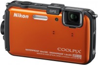
Nikon Coolpix AW110
 | When you make a purchase through links on our site, we may receive a affiliate commission. Buy!Nikon COOLPIX AW110 Wi-Fi and Waterproof Digital Camera with GPS SilverAmazon.comDelivery: in USA Report |
Nikon Coolpix AW110
Panel:1/2.3", 16 MPix
Focal length:28-140 mm
Lens aperture:f/3.9–f/4.8
Snapshot size:4608 x 3456 px
ISO range:125-3200
Burst shooting:8 fps
Screen:3 ''
A very original tourist class model, which is more like a hybrid of a protected camera and an advanced navigator than a classic camera. Carries a GPS module on board, which can be used separately without enabling photo functions; its features include an electronic compass and a built-in world map with location markers. There is also an altimeter and a hydrobarometer. The case is able to withstand immersion in water up to 18 m, there is a separate underwater filming programme. Wi-Fi support is also worth noting.
All specifications
Specifications Coolpix AW110
|
| ||||||||||||||||||||||||||||||||||||||||||||||||||||||||||||||||||||||||||||||||||||||||||||||||||||||||||||||||||||||||||||||||||||||||||||||
The information in the model description is for reference purposes.
Always clarify the specifications and configuration of the product with the online store manager before purchasing.
Catalog Nikon 2026 - new arrivals, bestsellers, and the most relevant models Nikon.
Always clarify the specifications and configuration of the product with the online store manager before purchasing.
Catalog Nikon 2026 - new arrivals, bestsellers, and the most relevant models Nikon.
Does a full frame make a difference? Is it worth buying a full-frame camera?Do I need to spend money on an expensive full frame or is it better to buy a cropped camera?..

Decoding Nikon Camera Series and Model LabelsIn this article, we will focus on decoding Nikon camera series.
Series Nikon AW, W, S (dustproof, waterproof)Compare using chart →
AccessoriesAll accessories for Nikon Coolpix AW110 →


Additional features digital camera Nikon Coolpix AW110:
- Ability to use as a GPS navigator, without turning on photo function
- Built-in electronic compass
- Built-in world map, with labels where the pictures were taken
- Using the included software, you can build routes based on date and time of the pictures, as well as the coordinates in which the picture was taken using the GPS module
- Protection class JIS/IEC 6
- The presence of an altimeter (records the exact height at which the picture was taken) and a hydrobarometer (measures depth)
We recommendCompare using chart →
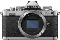
20 MP, screen: 3 '', oscillating, touch, ultra HD (4K) video, lens: focal: 20 mm, 256 g
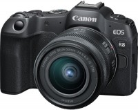
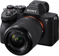
mirrorless, lens kits, 24 MP, screen: 3 '', oscillating, touch, ultra HD (4K) video, lens: 2 x, focal: 24 - 50 mm, 461 g
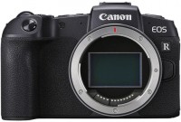
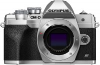
mirrorless, only body, 26 MP, screen: 3 '', oscillating, touch, ultra HD (4K) video, 485 g
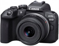
mirrorless, lens kits, 24 MP, screen: 3 '', oscillating, touch, ultra HD (4K) video, lens: 2.5 x, focal: 18 - 45 mm, 382 g
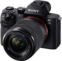
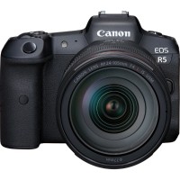
mirrorless, lens kits, 24.3 MP, screen: 3 '', oscillating, lens: 2.5 x, focal: 28 - 70 mm, 894 g
mirrorless, only body, 21 MP, screen: 3 '', oscillating, touch, ultra HD (4K) video, 445 g
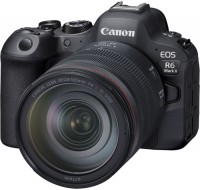
mirrorless, lens kits, 33 MP, screen: 3 '', oscillating, touch, ultra HD (4K) video, lens: 2.5 x, focal: 28 - 70 mm, 659 g
mirrorless, only body, 20 MP, screen: 3 '', oscillating, touch, ultra HD (4K) video, 383 g
mirrorless, lens kits, 24 MP, screen: 3 '', oscillating, touch, ultra HD (4K) video, lens: focal: 24 - 70 mm, 670 g
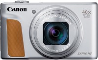
ultrazoom, 20 MP, screen: 3 '', oscillating, ultra HD (4K) video, lens: 40 x, focal: 24 - 960 mm, 299 g
mirrorless, lens kits, 45 MP, screen: 3.2 '', oscillating, touch, ultra HD (4K) video, video above 4K, lens: 4.3 x, focal: 24 - 105 mm, 738 g