Number of frequencies
The number of individual radiation frequencies that can be operated by a device with echo sounding function (see "Type").
The features of the frequencies themselves are described in detail below, but here we note that different models may provide different options for distributing frequencies over individual beams (see "Number of radiation beams"). So, in some devices, each beam has its own frequency, in others, individual emitters can be switched, choosing the best option depending on the characteristics of the situation. In general, more frequencies indicate greater versatility, but it significantly affects the price.
Radiation frequency
The frequency(s) of radiation at which the device with the echo sounder function is capable of operating (see "Type").
The higher the frequency, the better the resolution and noise immunity of the device, the better it is suitable for working at high speeds, but the range and coverage suffer. Low-frequency (up to 200 kHz) sensors, on the contrary, "reach" deep and cover a wide angle, but are sensitive to interference and do not work well with fine terrain details and small objects. Accordingly, the first option is considered optimal for shallow depths and high-precision topographic measurements, while the second option is for deep water bodies, as well as for searching for fish and other tasks that require wide coverage.
Models with several radiation beams (see “Number of radiation beams”) often provide different frequencies for individual beams, which allows you to combine the advantages of different options in one device and compensate for their disadvantages.
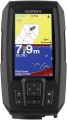
Display
— Screen size. Diagonal screen size in inches. The
larger the screen, the more information can be displayed on it and the more detailed this information can be. On the other hand, this parameter noticeably affects the dimensions of the device, and large screens are expensive, especially since you need the appropriate resolution for normal image quality (see below).
—
Touch. The presence of a sensor in the design of the display. This feature allows you to control the device by touching the icons on the screen — similar to how it is done in smartphones and tablets. Touch control provides more options than the classic one, using buttons and switches, besides it is more visual — however, such devices are more expensive.
— Display resolution. Display size in dots (pixels) horizontally and vertically. The higher the resolution, the more detailed image the screen is able to produce, the smaller objects can be clearly displayed on it and the more comfortable viewing. At the same time, the specificity of echo sounders is such that too high resolution is not required even for high-end models: for example, modest by the standards of smartphones or tablets 640x480 with a 5" screen are considered quite sufficient even for an advanced device.
— Colour. The ability of a screen to display colours. In this case, the simplest division is used:
Monochrome.... Displays that display information only in shades of one colour. Theoretically, the main colour can be any, but in this case, the vast majority of monochrome screens are black and white. Their advantages are low cost and energy consumption, as well as good visibility in the sun; at the same time, such an image allows you to work with quite a variety of types of data, which is enough even for very advanced echo sounders (see "Type"). However, this variety is not as wide as for colour displays, as a result, for chartplotters (see ibid.), such an image is not suitable — if it is impossible to display different colours, some of the important information on the maps is lost.
Coloured. Screens capable of working with multiple colours. The variety of colours can be quite small, but the image still turns out to be more informative than black and white: different colours can indicate different depths on the map, water temperature changes, etc. Due to this, this type of display is found in all types of navigation devices (see above). Its main disadvantage can be called a higher cost than that of monochrome screens.
— Backlight. The screen has its own backlight system. This feature makes the display independent of ambient light and allows you to see the information on it even in complete darkness. At the same time, the backlight increases power consumption, which is important during long-term operation from an autonomous source (for example, a boat battery). Therefore, it can be turned off.Adding new maps
Ability to load new navigation charts into the chartplotter.
This possibility is extremely important in the light of two points. First, the base map (see above) rarely provides the level of detail needed to be used effectively — you have to download more detailed maps of individual areas. Secondly, it is very desirable to update even already loaded maps from time to time, since hydrographic information (depths, currents, shoals, fairway location, etc.) is constantly changing.