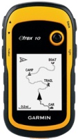
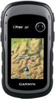
Garmin eTrex 10
 | Compare prices 4 → When you make a purchase through links on our site, we may receive a affiliate commission.
|
Garmin eTrex 10
Type:handheld
Screen size:2.2 "
Resolution:120х160 px
Power supply:non chargeable battery
Working hours:up to 25 h
Weight:142 g
Hiking GPS navigator with support for the Russian satellite navigation system GLONASS. The case protected from dust and moisture allows to use it in extreme campaigns, in any weather and on any terrain. Thanks to the use of a monochrome display, the device is very economical and not demanding on energy, two AA batteries will last for 25 hours of continuous operation of the gadget. This model can remember up to 50 routes.
All specifications
Specifications eTrex 10
|
| |||||||||||||||||||||||||||||||||||||||||||||||||||||||||||||
The information in the model description is for reference purposes.
Always clarify the specifications and configuration of the product with the online store manager before purchasing.
Catalog Garmin 2026 - new arrivals, bestsellers, and the most relevant models Garmin.
Always clarify the specifications and configuration of the product with the online store manager before purchasing.
Catalog Garmin 2026 - new arrivals, bestsellers, and the most relevant models Garmin.
Buy Garmin eTrex 10
When you make a purchase through links on our site, we may receive a affiliate commission.
GARMIN 010-11602-00 AUTO FRICTION MOUNT | $38.12 | ||||
GARMIN 010-12390-11 OTG ADAPTER CABLE FOR GPSMAP 8400/8600 | $70.12 | ||||
Garmin� Etrex 10 Worldwide GPS 010-00970-00 | $120.49 | ||||
Garmin eTrex 10 Worldwide Handheld GPS Navigator - 010-00970-00 010-00970-00 | $129.99 | ||||
Series Garmin eTrex (handheld)Compare using chart →
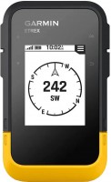
handheld, 2.2 ", water protection IPX7, non chargeable batteries, up to 168 hours of work, 157 g
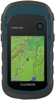
handheld, 2.2 ", memory 8 GB, water protection IPX7, non chargeable batteries, up to 25 hours of work, 142 g
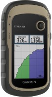
handheld, 2.2 ", memory 8 GB, ANT+, water protection IPX7, non chargeable batteries, up to 25 hours of work, 142 g
handheld, 2.2 ", water protection IPX7, non chargeable batteries, up to 25 hours of work, 142 g
handheld, 2.2 ", memory 3.7 GB, water protection IPX7, non chargeable batteries, up to 25 hours of work, 142 g
Model overview based on user reviews
The Garmin eTrex 10 is a reliable GPS navigator, praised for its excellent signal reception even through thick concrete walls and in open areas like fields and forests. It features a cool track back function that automatically records your route, allowing easy navigation back if you get lost. The device is user-friendly, compact, and waterproof, making it ideal for hiking. It has a long battery life, lasting more than a day when continuously on, and can last up to a month with intermittent use. Although it has a black and white screen and may freeze slightly when marking route points, it remains a valuable tool for outdoor adventures. The lack of a belt clip and the protruding joystick button are minor drawbacks. Overall, the Garmin eTrex 10 is an affordable and effective choice for hikers, as it proved invaluable during a trip to Crimea.
Pros
Cons
affordable price, just an ideal thing for hiking, it came in handy for us in the Crimea, we got lost a couple of times and it saved us. I recommend hikers to get such a thing. excellent quality of signal reception anywhere, even through thick concrete walls, in open areas, fields, forests, the reception is simply great there, there is a cool track back function, it automatically writes the route you are taking, then you can always return along the same route if I went to the wrong place or ended up in impassable terrain. You can easily read or upload information via USB, the battery is just crazy enough for more than a day when turned on, even if you screwed up, turning it on for 5 minutes is not a problem at all, it’s enough for at least a month of hiking with this method of use. Ease of use, small, waterproof, always easy to hide under clothes, the plastic is quite strong. It freezes a little when marking route points, either it is recalculating or there really isn’t enough satellite signal to think faster. Well, the drawback is the black and white screen, everything is of course simple, this is not Google Maps with a satellite view, but nevertheless it is a very useful thing. There is no fastening to the belt like a clip or something like that. And then there’s the protruding joystick button, it really sticks out and gets in the way if it’s lying close together somewhere. |
Add Review
Video reviews

Garmin eTrex 10 - Saving a Waypoint
6 October 20219 717 view

Garmin eTrex 10 - Go Geocaching
7 October 20218 896 view
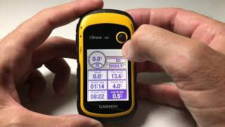
Garmin eTrex 10 - Using Trip Computer
6 October 20215 659 view

Garmin eTrex 10 - See Clock and adjust time display 12 / 24 hour format
21 January 20214 428 view

Garmin eTrex 10, 20, and 30 slip case
16 January 20182 702 view

Garmin eTrex 10 - View Hunt / Fish Times
22 January 20212 602 view

Garmin eTrex 10 - Adjust Backlight / Screen Brightness
6 October 20211 974 view

Garmin eTrex 10 - How To Adjust Your Backlight Brightness
21 January 20211 912 view

Geocaching in Germany | Using a Garmin eTrex 10
13 January 20191 830 view

Garmin eTrex 10 - Specify Battery Type
28 October 20211 826 view

Garmin eTrex 10 Worldwide Handheld GPS Navigator - Review 2022
3 December 20211 474 view

Garmin eTrex 10 - Change Data Field Elements on Map
5 October 20211 319 view

Garmin eTrex 10 - Clear Recently Found Items
5 October 20211 295 view

Garmin eTrex 10 - Adjust Page Sequence
7 October 2021937 view

Garmin eTrex® 10 Full Training In Urdu/Hindi|MappingWithAdnan
7 June 2022652 view

How to install the batteries into the Garmin etrex 10
11 October 2020351 view

Garmin eTREX 10 best deal #navigation #garmin #landmeasurement #trekking #adventure #techunboxing
30 August 2024246 view
Additional features sat nav Garmin eTrex 10:
WAAS technology
WAAS (Wide Area Augmentation System) is a system designed to increase the accuracy of satellite navigation instruments. The principle of operation of the system is based on the correction of satellite data with the help of special corrections, which are calculated by base stations installed in the service area of the system.
- WAAS technology
- Lunar and solar calendar
- Area calculation
WAAS technology
WAAS (Wide Area Augmentation System) is a system designed to increase the accuracy of satellite navigation instruments. The principle of operation of the system is based on the correction of satellite data with the help of special corrections, which are calculated by base stations installed in the service area of the system.
We recommendCompare using chart →

handheld, 1.27 ", ANT+, water protection IPX7, battery 1250 mAh, up to 90 hours of work, 100 g
handheld, 2.2 ", memory 8 GB, water protection IPX7, non chargeable batteries, up to 25 hours of work, 142 g
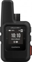
handheld, 1 ", ANT+, water protection IPX7, battery 1250 mAh, up to 96 hours of work, 100 g
handheld, 2.2 ", memory 8 GB, ANT+, water protection IPX7, non chargeable batteries, up to 25 hours of work, 142 g

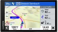
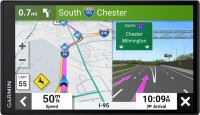
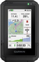
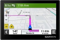
campers, 6.95 ", memory 16 GB, Lane Guidance, Wi-Fi, magnetic mount, up to 1 hours of work, 240 g
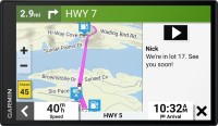
campers, 10 ", memory 32 GB, map update, Live Traffic, Lane Guidance, Wi-Fi, magnetic mount, up to 2 hours of work, 554 g
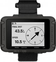
wrist-mounted, 2.2 ", ANT+, water protection IPX7, non chargeable batteries, up to 100 hours of work, 108 g