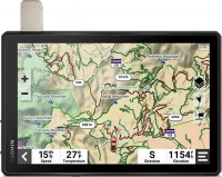
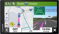
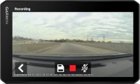
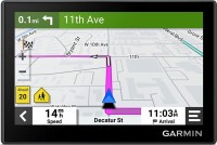
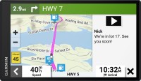
Garmin Tread XL Overland Edition All-Terrain
 |
Close
Garmin Tread XL Overland Edition All-Terrain
Type:cars
Screen size:10.1 "
Resolution:1280x800 px
Built-in memory:32 GB
Interfaces:Wi-Fi, Bluetooth
Working hours:up to 6 h
Weight:930 g
All specifications
Specifications Tread XL Overland Edition All-Terrain
|
| |||||||||||||||||||||||||||||||||||||||||||||||||||||||||||||||||||
The information in the model description is for reference purposes.
Always clarify the specifications and configuration of the product with the online store manager before purchasing.
Catalog Garmin 2025 - new arrivals, bestsellers, and the most relevant models Garmin.
Always clarify the specifications and configuration of the product with the online store manager before purchasing.
Catalog Garmin 2025 - new arrivals, bestsellers, and the most relevant models Garmin.
Buy Garmin Tread XL Overland Edition All-Terrain
When you make a purchase through links on our site, we may receive a affiliate commission.
Garmin Tread XL Overland All-Terrain Navigator Rugged Built in Mapping iOverlander Ultrabright Display Large 010-02509-00 | $1,499.99 | ||||
Garmin Tread XL - Overland Edition 75375927759 | $1,499.99 | ||||
Garmin Tread XL Overland Edition 10" GPS All-Terrain Navigator, Black 010-02509-00 | $1,499.99 | ||||
Video reviews
We recommendCompare using chart →
campers, 6.95 ", memory 32 GB, map update, Live Traffic, Lane Guidance, dashcam, Wi-Fi, up to 0.5 hours of work, 271 g
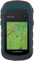
handheld, 2.2 ", memory 8 GB, water protection IPX7, non chargeable batteries, up to 25 hours of work, 142 g

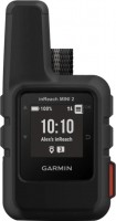
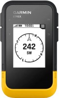
handheld, 1 ", ANT+, water protection IPX7, battery 1250 mAh, up to 96 hours of work, 100 g
handheld, 2.2 ", memory 8 GB, ANT+, water protection IPX7, non chargeable batteries, up to 25 hours of work, 142 g
campers, 6.95 ", memory 16 GB, Lane Guidance, Wi-Fi, magnetic mount, up to 1 hours of work, 240 g
handheld, 2.2 ", water protection IPX7, non chargeable batteries, up to 168 hours of work, 157 g
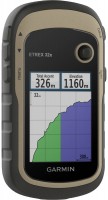
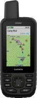
handheld, 2.6 ", memory 16 GB, ANT+, water protection IPX7, non chargeable batteries, up to 16 hours of work, 217 g

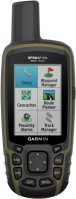
handheld, 3 ", memory 16 GB, Wi-Fi, ANT+, water protection IPX7, up to 180 hours of work, 230 g
handheld, 3 ", memory 16 GB, Wi-Fi, ANT+, water protection IPX7, up to 180 hours of work, 230 g
