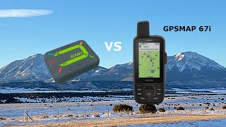
Garmin GPSMAP 67i (010-02812-00)
 | Compare prices 4 → When you make a purchase through links on our site, we may receive a affiliate commission.
|
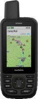
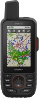
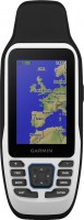
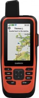
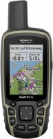
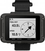
Garmin GPSMAP 67i
Type:handheld
Screen size:3 "
Resolution:240x400 px
Built-in memory:16 GB
Interfaces:Wi-Fi, Bluetooth
Working hours:up to 180 h
Weight:230 g
Synchronization with smartphone. Area calculation function. 3-axis compass. Built-in VIRB remote control for remote control of your Garmin VIRB camera. LED flashlight
Device operating temperature range: from - 20 °C to 60 °C. Compatible with inReach satellite navigator.
All specifications
Specifications GPSMAP 67i
|
| |||||||||||||||||||||||||||||||||||||||||||||||||||||||||||||||||||||||||
The information in the model description is for reference purposes.
Always clarify the specifications and configuration of the product with the online store manager before purchasing.
Catalog Garmin 2026 - new arrivals, bestsellers, and the most relevant models Garmin.
Always clarify the specifications and configuration of the product with the online store manager before purchasing.
Catalog Garmin 2026 - new arrivals, bestsellers, and the most relevant models Garmin.
Buy Garmin GPSMAP 67i
When you make a purchase through links on our site, we may receive a affiliate commission.
Garmin 67i 010-02812-00 Hiking Handheld GPS Device With 3" Display And inReach Satellite Technology | $599.99 | ||||
Garmin - GPSMAP 67i 3" GPS with Built-In Bluetooth - Black 010-02812-00 | $839.95 | ||||
Garmin - GPSMAP 67i Handheld Hiking GPS with inReach SOS Bundle - Black 010-02812-00-AG2-2 | $864.95 | ||||
Garmin - GPSMAP 67i Rugged GPS Handheld Bundle - Black 010-02812-00Ag2 | $874.95 | ||||
Series Garmin GPSMAP (tracking)Compare using chart →

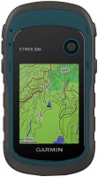
handheld, 3 ", memory 16 GB, Wi-Fi, ANT+, water protection IPX7, up to 180 hours of work, 230 g
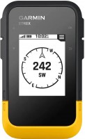
handheld, 2.6 ", memory 16 GB, ANT+, water protection IPX7, non chargeable batteries, up to 16 hours of work, 217 g
handheld, 3 ", memory 16 GB, Wi-Fi, ANT+, water protection IPX7, up to 35 hours of work, 230 g
handheld, 3 ", memory 8 GB, water protection IPX7, non chargeable batteries, up to 19 hours of work, 282 g
handheld, 3 ", memory 16 GB, Wi-Fi, ANT+, water protection IPX7, up to 180 hours of work, 230 g
handheld, 3 ", memory 4 GB, Wi-Fi, ANT+, water protection IPX7, up to 18 hours of work, 272 g
handheld, 2.6 ", water protection IPX7, non chargeable batteries, up to 20 hours of work, 260 g
handheld, 2.6 ", water protection IPX7, non chargeable batteries, up to 18 hours of work, 203 g
handheld, 2.6 ", memory 16 GB, ANT+, water protection IPX7, non chargeable batteries, up to 16 hours of work, 217 g
Video reviews

Garmin inReach Mini 2 vs GPSMAP 67i Field Test
27 June 202315 455 view

Mini 2 vs GPSMAP 67i - What One I Like Best
22 July 20246 057 view
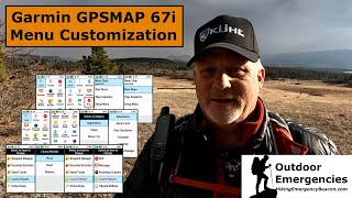
Customize Your Garmin GPSMAP 67i Menus
24 March 20235 086 view

Garmin GPSMAP 67i Geocaching Tutorial
19 December 20232 894 view

Garmin GPSMAP 67i Geocaching Setup
12 December 20232 778 view

STEP by STEP Walkthrough on How To Customize Your GPSMAP 67i Menus
26 August 20232 634 view

Garmin GPSMAP 67i Quick Text Messages
26 March 20232 528 view
STEP by STEP Walkthrough on How To Customize Your GPSMAP 67i Menus
27 August 20232 519 view

Will the Garmin inReach Mini 2 and the GPSMAP 67i FLOAT?
23 July 20232 288 view

Garmin GPSMAP 67i – Entistäkin tarkempi ja monipuolisempi
22 April 20232 097 view

Tracking & TracBack Test Between the Garmin Messenger Plus the inReach Mini 2 and the GPSMAP 67i
13 October 20241 938 view
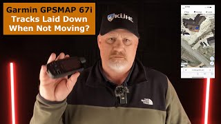
Garmin GPSMAP 67i Tracking When Not Moving
24 April 20231 525 view
ZOLEO vs Garmin GPSMAP 67i
30 September 20231 283 view

Garmin GPSMAP 67i Battery Life Test 2 of 5
6 April 20231 165 view

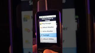
Garmin GPSMAP 67i Flashlight
29 June 20231 142 view

How to Change the Data Field Size in Your GPSMAP 67i
9 June 20231 136 view

SPOT X vs Garmin GPSMAP 67i
28 July 20231 069 view

Garmin GPSMAP 67i Battery Life Test 4 of 5
14 April 2023816 view

Geocaching DNF with the Garmin GPSMAP 67i
18 December 2023715 view

MapShare at Cheesman Canyon with the Garmin GPSMAP 67i
2 August 2023350 view
We recommendCompare using chart →
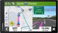
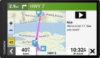
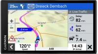
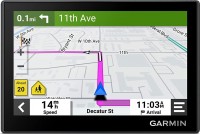
campers, 8 ", memory 32 GB, map update, Live Traffic, Lane Guidance, Wi-Fi, magnetic mount, up to 2 hours of work, 405 g

campers, 6.95 ", memory 32 GB, map update, Live Traffic, Lane Guidance, dashcam, Wi-Fi, up to 0.5 hours of work, 271 g
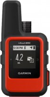
handheld, 1.27 ", ANT+, water protection IPX7, battery 1250 mAh, up to 90 hours of work, 100 g
handheld, 2.2 ", memory 8 GB, water protection IPX7, non chargeable batteries, up to 25 hours of work, 142 g
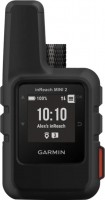
handheld, 1 ", ANT+, water protection IPX7, battery 1250 mAh, up to 96 hours of work, 100 g
handheld, 2.6 ", memory 16 GB, ANT+, water protection IPX7, non chargeable batteries, up to 16 hours of work, 217 g

campers, 6.95 ", memory 16 GB, Lane Guidance, Wi-Fi, magnetic mount, up to 1 hours of work, 240 g
handheld, 2.2 ", water protection IPX7, non chargeable batteries, up to 168 hours of work, 157 g
wrist-mounted, 2.2 ", ANT+, water protection IPX7, non chargeable batteries, up to 100 hours of work, 108 g