Comparison Garmin eTrex 10 vs Magellan eXplorist 210
Add to comparison | 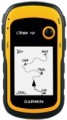 | 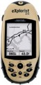 |
|---|---|---|
| Garmin eTrex 10 | Magellan eXplorist 210 | |
| Compare prices 4 | from $315.00 | |
| User reviews | ||
| TOP sellers | ||
| Application area | handheld | handheld |
| Water protection IPX7 | ||
Software | ||
| Number of routes | 50 | 20 |
| Waypoints | 1000 | 500 |
| Navigation functions (assistants) | track back | |
Receiver | ||
| Bands number | 14 | |
| GLONASS | ||
Display specs | ||
| Display | 2.2 " 120х160 px | 120х160 px |
Additional equipment | ||
| More features | image display | image display |
Connections | ||
| Interfaces | USB | USB |
General | ||
| Power supply | non chargeable batteries | rechargeable battery |
| Battery life | 25 h | 18 h |
| Dimensions (HxWxT) | 103x54x33 mm | 117x53x33 mm |
| Weight | 142 g | 110 g |
| Added to E-Catalog | october 2011 | july 2008 |
Compare Garmin eTrex 10 and Magellan eXplorist 210
Price comparison
You may be interested in
My comparisons
Garmin eTrex 10 often compared


Glossary
Number of routes
The maximum number of routes that can be entered into the memory of the GPS navigator.
The ability to save routes is convenient, first of all, for those who regularly have to travel the same roads: instead of laying the path anew each time, it is enough to select the appropriate route in the navigator's memory. As for the number of "remembered" routes, in modern navigators it can reach several hundred, but large amounts of memory cost accordingly. Therefore, when choosing according to this parameter, one should take into account real needs: for example, it is hardly worth specifically looking for a model for 50 routes or more if your regular trips are limited to 5-6 places in the city and 2-3 places outside the city.
The ability to save routes is convenient, first of all, for those who regularly have to travel the same roads: instead of laying the path anew each time, it is enough to select the appropriate route in the navigator's memory. As for the number of "remembered" routes, in modern navigators it can reach several hundred, but large amounts of memory cost accordingly. Therefore, when choosing according to this parameter, one should take into account real needs: for example, it is hardly worth specifically looking for a model for 50 routes or more if your regular trips are limited to 5-6 places in the city and 2-3 places outside the city.
Waypoints
The maximum number of waypoints that can be stored in the navigator.
A waypoint is a point on the map with specific coordinates set by the user. Such points can be used both to mark individual important places (work / home, regularly visited institutions in the city, camps or springs in nature, etc.), and when laying routes (it is convenient to designate intermediate points through which you must pass the route). The more points the navigator is able to "remember" — the wider its capabilities; in the most advanced models, this number can reach 10,000 or even more. On the other hand, extensive memory will also cost more.
A waypoint is a point on the map with specific coordinates set by the user. Such points can be used both to mark individual important places (work / home, regularly visited institutions in the city, camps or springs in nature, etc.), and when laying routes (it is convenient to designate intermediate points through which you must pass the route). The more points the navigator is able to "remember" — the wider its capabilities; in the most advanced models, this number can reach 10,000 or even more. On the other hand, extensive memory will also cost more.
Navigation functions (assistants)
Special navigation functions provided in the device.
— Speed limit. A function that allows you to use the navigator to obtain information about the speed limit on a particular road. Most often, the speed limit is used in the operational prompt mode: the device warns the driver in advance about approaching a section of the road where the speed limit differs from the current one, and also issues a warning if the driver accelerates above the permissible limit. This can prevent not only an unpleasant conversation with the traffic police, but also a serious accident.
— Traffic jams in real time. A function that allows the driver to see real-time traffic data on the device screen. As a rule, models with a traffic monitoring function provide detailed information about the volume of traffic in general. Moreover, this information is monitored and updated constantly, in real time, and is immediately taken into account by the navigator - to the point that if difficulties arise on a pre-planned route, the device can automatically reroute it to avoid congestion. At the same time, it is worth considering that real-time traffic data is usually transmitted through the TMC network (see “TMC receiver”), and it is not available everywhere.
— GPS informant. A function to provide the driver with various useful information related to the current location. In acc...ordance with the name, the coordinates are determined using GPS. One of the most common ways to use an informant is to warn about approaching traffic cameras, stationary traffic police posts and speed control systems. In addition, other functions may be provided - for example, informing about entering a section of the road with a high accident rate or a separate large hole on the roadway. To operate the GPS informer, a database of relevant objects is entered into the device’s memory. When purchasing a navigator, it doesn’t hurt to clarify what exactly this database contains, how recent it is, and whether it can be updated.
— Lane selection. A function that provides the driver with hints regarding lane selection. Such tips make driving more convenient and safe: the navigator warns the driver in advance about the need to change lanes for a turn/turn (or vice versa, in order to drive straight past the turn). This allows you to avoid “misses” on the road and emergency lane changes, which often create emergency situations. This function is especially relevant for complex interchanges on multi-lane highways.
— Parking in real time. As its name suggests, this feature allows you to determine if there are nearby parking options for your vehicle. In addition, navigators that support the real-time parking function are also capable of displaying various auxiliary information, for example, type of parking, parking cost, payment methods, etc.
— The way back. The function of using a record of the distance traveled as a route to return from the finish point to the start point. Thanks to it, the customer can go back the same way he got to the current point. This opportunity is especially important in conditions of difficult terrain and the absence of roads - for example, during hiking trips or off-road jeep trips: returning along an already explored path is often easier and safer than looking for a new route. Actually, the opposite way is found mainly among universal pocket navigators (see “Scope of Application”), although there are exceptions - for example, the same car models.
- “Where am I?”. A function that helps the customer determine their current location. At the same time, we are talking not only about a point on the map and geographic coordinates - in addition to this data, the navigator, when you turn on the “Where am I?” function. displays various additional information: the address of the nearest building, information about the nearest intersection, nearby important objects (gas stations, hospitals, police stations, etc.).
— Prices at gas stations in real time. A function that provides information about current fuel prices at various gas stations along your travel route. It can be useful for drivers, as it allows them to find the most profitable or nearest gas stations to refuel and save money.
— Weather in real time. A feature that allows the navigator to receive real-time weather data. This can be either information about current weather conditions in a particular place on the map, or a forecast for a certain period. In addition to basic weather information (temperature, fit, wind, humidity, fog, etc.), this service can support advanced data such as storm warnings, flood or landslide reports. The necessary data can arrive in different ways - most often through a satellite or a special radio channel. These details should be clarified separately.
- Supervision of children. A function that allows the driver to use the navigator screen to observe the rear seat of the car without turning around and without being distracted from the road. Most often it is used to monitor a child who is in the back seat. Of course, to use the child monitoring function you will need not only a navigator, but also a camera compatible with it.
Bands number
The number of communication channels supported by the navigator.
One communication channel allows the device to receive one operating frequency from one satellite. Without going into unnecessary details, we can say that the greater the number of channels, the more efficient the navigator works (including in dense urban areas and other adverse conditions) and the less time it takes for a “cold” start. On the other hand, numerous supported frequencies complicates the receiver and increases its cost.
As for the specific number, 12 channels are needed to work effectively with GPS, but today such receivers are considered obsolete and are almost never used. Most low-cost receivers support about 20 channels (there are also more modest solutions, at 16 or even 14 frequencies), mid-range solutions have about 30 – 40 channels, and in advanced models this number is most often 64 or 66 (although sometimes more) .
GLONASS
The navigator's ability to work with the GLONASS satellite navigation system. GLONASS (GLObal'naya NAvigatsionnaya Sputnikovaya Sistema) is a Russian navigation system, the only currently functioning alternative to the American GPS. It has been operating in full format since October 2011. GLONASS itself has slightly lower accuracy than GPS, so it is rarely used in its "pure" form - usually navigators receive signals from both satellite systems at once. This format ensures positioning accuracy of up to 1.5 m. In addition, the navigator's ability to work with GLONASS ensures reliability in the event of a failure or breakdown of one of the navigation systems (although unlikely, but theoretically possible).
Display
Parameters of the display installed in the navigator.
— Display diagonal. Size screen size in inches. The larger the screen, the more information can be displayed on it and the more detailed this information will be presented. On the other hand, the size of the display significantly affects the dimensions of the device, and large screens are more expensive.
— Display resolution. Display size in dots (pixels) horizontally and vertically. The higher the resolution (with the same diagonal), the more detailed and clear the image the screen can produce. In addition, on high-resolution displays, small details are better visible, which increases the comfort of viewing information. Too high a resolution is usually not required for GPS navigator displays: for example, 800x480 pixels, limited by the standards of smartphones or tablets, with a diagonal screen size of about 6” are considered quite sufficient even for an advanced device.
— Matrix type. This parameter is indicated mainly for tech cases when the screen uses a high-quality IPS type matrix. This technology provides high quality color rendering, good brightness and wide viewing angles; moreover, IPS screens are relatively inexpensive to produce.
- Touch. Screen support for touch control. You can give commands to the device by touching the icons on the display itself - similar to how this is done in smartphones and tablets. Touch control opens up...many more possibilities than classic controls and provides flexibility in working with the navigator. In particular, by touching the screen you can set points on the route, zoom in or out on the map, etc.
- Color. This parameter determines whether the screen is color or monochrome (black and white). Black and white displays are simple, inexpensive, consume little power, and are quite suitable for displaying basic navigation information. At the same time, color screens are more functional: maps often use different colors to highlight individual objects, which would not be possible on monochrome displays. As a result, black and white screens are quite rare among modern navigators - mainly among the most compact and inexpensive models.
— Backlight. The screen has its own backlight system. This function makes the device independent of external lighting: the illuminated image will be normally visible both at dusk and even in complete darkness. It is also worth noting that many LCD screens have a backlight by default; it is activated when the screen itself is turned on and works regardless of external lighting - without it, the image on the matrix would simply be impossible to see. In particular, this operating principle is used in IPS-type matrices, which have gained popularity in modern portable electronics (including navigators).
Power supply
This paragraph takes into account only the type of autonomous power source (batteries or accumulator).
- Battery. In this case, we mean our own original battery, which is not of a standard size, and in some cases is not removable at all. One of the advantages of this option is that the battery is included in the package and does not need to be purchased separately, unlike batteries. And the use of such a device does not require additional costs - a dead battery just needs to be charged. However, the main disadvantage of such power is also that when the charge is depleted, the device will have to be charged - and this requires time and a power source. However, it is worth noting that most battery models are designed to work in a car or motorcycle and have the ability to connect to a 12 V network. As a result, most of the time such a navigator receives power from the car, and the battery is used only when disconnected from the on-board network. So the mentioned drawback can hardly be called critical.
— Batteries. Powered by replaceable elements of a standard size - for example, “finger-type” AA. Note that among such elements there are both disposable batteries and rechargeable batteries. This gives the user a choice: regularly purchase fresh elements or spend money once on batteries and a “charger” for them. However, in any case, power from batteries is associated with additional costs - such power supplies are usually n...ot included in the kit, and they have to be purchased separately. At the same time, this option has an important advantage: a dead battery can be quickly replaced with a fresh one. This option is found mainly among universal models.
Battery life
The operating time of the navigator on one battery charge or a set of batteries depends on the power source (see above).
This parameter is more visual and closer to reality than technical information about the type of batteries, battery capacity, etc. However note that the operating time is usually indicated for a conditional perfect situation: a good signal level without the need to reconnect, low screen brightness ( or completely turned off the backlight), minimal use of wireless modules (Wi-Fi, Bluetooth), etc. Practical conditions inevitably differ from perfect — accordingly, the operating time may differ noticeably from the claimed one (usually in the direction of reduction, but sometimes vice versa) . Nevertheless, the operating time stated in the characteristics is quite reliable information, and it is quite possible to evaluate the capabilities of the selected device, as well as compare it with other models.
This parameter is more visual and closer to reality than technical information about the type of batteries, battery capacity, etc. However note that the operating time is usually indicated for a conditional perfect situation: a good signal level without the need to reconnect, low screen brightness ( or completely turned off the backlight), minimal use of wireless modules (Wi-Fi, Bluetooth), etc. Practical conditions inevitably differ from perfect — accordingly, the operating time may differ noticeably from the claimed one (usually in the direction of reduction, but sometimes vice versa) . Nevertheless, the operating time stated in the characteristics is quite reliable information, and it is quite possible to evaluate the capabilities of the selected device, as well as compare it with other models.