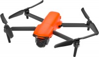
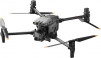
Autel Evo II Dual 640T Rugged Bundle RTK v3
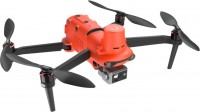 | $4,799.00 Buy! Autel Robotics Evo II V3 Dual 640T Rugged Thermal Drone Bundle 102001512Amazon.comDelivery: in USA Report |
Autel Evo II Dual 640T Rugged Bundle RTK v3
Flight:up to 40 min, range 25 km, speed 72 km/h
Filming a video:1920x1080 px 60 fps, 3840x2160 px 60 fps, 2720x1530 px 60 fps
Camera:thermal imaging removable, gimbal for stabilization
Dimensions:558x457x143 mm, foldable
Weight:1250 g
12 sensors to detect obstacles in any direction. Quick release propellers. Shooting photos in RAW. Flight range - up to 21 km. Flight time - up to 40 minutes. Hyperlapse shooting mode. The maximum height is 7 km.
It differs from v1 by supporting a dual-band connection between the controller and the quadcopter, from v2 by supporting Live Deck 2.0, improved night shooting and support for SkyLink 2.0 (transmission up to 15 km).
All specifications
Specifications Evo II Dual 640T Rugged Bundle RTK v3
|
| ||||||||||||||||||||||||||||||||||||||||||||||||||||||||||||||||||||||||||||||||||||||||||||||||||||||||||||||||||||||||
The information in the model description is for reference purposes.
Always clarify the specifications and configuration of the product with the online store manager before purchasing.
Catalog Autel 2025 - new arrivals, bestsellers, and the most relevant models Autel.
Always clarify the specifications and configuration of the product with the online store manager before purchasing.
Catalog Autel 2025 - new arrivals, bestsellers, and the most relevant models Autel.
Video reviews
Additional features drone Autel Evo II Dual 640T Rugged Bundle RTK v3:
- Built-in memory — 8 GB
- Image magnification up to 16x (up to 4x without loss of quality)
- ISO - 100 to 64000
- Focal length from 0.5 m to infinity (autofocus)
- Image magnification up to 16x (up to 4x without loss of quality)
- Maximum wind resistance up to 12 m/s
- The RTK module uses a multi-frequency positioning system (GPS L1+L2, GLONASS L1+L2, Galileo E1+E5, BeiDou B1+B2)
- The cold start time of navigation systems is up to 50 seconds. Positioning accuracy up to 1.5 cm in vertical and up to 1 cm in horizontal planes.
- Built-in thermal imager: 640x512, temperature measurement ranges -20°..+150° and 0°..+550°, measurement distance 2..20 m, picture-in-picture resolution 1080p
We recommendCompare using chart →

