Scan depth
the
maximum depth at which the sonar locator (see "Type") is able to operate effectively — in other words, how deep underwater the device is able to "see".
It is worth choosing an echo sounder according to this parameter, taking into account the actual depths at which it is planned to be used. Of course, this does not place a certain margin, but within reasonable limits (15-20%, less). For example, it hardly makes sense to specially take a model with a scanning depth of 200 m for a lake with pits of 30-40 m — such devices are expensive, while there will simply be nowhere to realize their full potential, and a powerful signal can also scare away the fish. But for marine or oceanic applications, a depth of a kilometer or more may be required; the most advanced echo sounders are quite capable of providing it.
Total radiation angle
The angle covered during operation by the transducer of the echo sounder (or an instrument with such a function, see "Type").
Technically, the
wider the angle, the better the echo sounder is suitable for finding fish and other underwater objects, because. a large coverage area reduces the likelihood of missing prey. On the other hand, to accurately determine the depth, the beam must be as narrow as possible. This is due to the fact that the depth is determined by the maximum protruding point that fell under the beam; thus, if the size of the hole at the bottom is smaller than the spot from the beam, the device simply will not notice this hole. The smaller the angle (and, accordingly, the projection of the beam onto the bottom) — the less likely this phenomenon is.
However, it should be taken into account that all of the above is unambiguously true only for single-beam echo sounders (see "Number of radiation beams"). But multibeam models, usually, combine beams of different widths, thus compensating for the shortcomings of narrow and wide angles. In them, the total radiation angle describes only the dimensions of the space covered by the device.
Emitter power
The power output by the fishfinder (or fishfinder-chartplotter, see "Type") when operating.
The
more powerful the emitter, the more “long-range” the device turns out, the greater the depth at which it can work normally (see above). However, do not forget that the practical capabilities of an echo sounder depend on a number of other parameters, ranging from operating frequencies and angles (see above) to the quality of the receiver and the features of signal processing algorithms. In addition, different manufacturers may indicate different types of power in the characteristics: in some cases it is peak (maximum power at the time of a single pulse), in others it is RMS (rms power calculated over a certain period of time and obtained below peak). Therefore, we can say that the role of this parameter is usually purely reference, and when choosing, it is worth focus on moments that are closer to practice (for example, the same scanning depth).
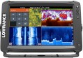
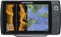
Display
— Screen size. Diagonal screen size in inches. The
larger the screen, the more information can be displayed on it and the more detailed this information can be. On the other hand, this parameter noticeably affects the dimensions of the device, and large screens are expensive, especially since you need the appropriate resolution for normal image quality (see below).
—
Touch. The presence of a sensor in the design of the display. This feature allows you to control the device by touching the icons on the screen — similar to how it is done in smartphones and tablets. Touch control provides more options than the classic one, using buttons and switches, besides it is more visual — however, such devices are more expensive.
— Display resolution. Display size in dots (pixels) horizontally and vertically. The higher the resolution, the more detailed image the screen is able to produce, the smaller objects can be clearly displayed on it and the more comfortable viewing. At the same time, the specificity of echo sounders is such that too high resolution is not required even for high-end models: for example, modest by the standards of smartphones or tablets 640x480 with a 5" screen are considered quite sufficient even for an advanced device.
— Colour. The ability of a screen to display colours. In this case, the simplest division is used:
Monochrome.... Displays that display information only in shades of one colour. Theoretically, the main colour can be any, but in this case, the vast majority of monochrome screens are black and white. Their advantages are low cost and energy consumption, as well as good visibility in the sun; at the same time, such an image allows you to work with quite a variety of types of data, which is enough even for very advanced echo sounders (see "Type"). However, this variety is not as wide as for colour displays, as a result, for chartplotters (see ibid.), such an image is not suitable — if it is impossible to display different colours, some of the important information on the maps is lost.
Coloured. Screens capable of working with multiple colours. The variety of colours can be quite small, but the image still turns out to be more informative than black and white: different colours can indicate different depths on the map, water temperature changes, etc. Due to this, this type of display is found in all types of navigation devices (see above). Its main disadvantage can be called a higher cost than that of monochrome screens.
— Backlight. The screen has its own backlight system. This feature makes the display independent of ambient light and allows you to see the information on it even in complete darkness. At the same time, the backlight increases power consumption, which is important during long-term operation from an autonomous source (for example, a boat battery). Therefore, it can be turned off.Connection interfaces
—
Ethernet. This standard is also known as LAN or RJ-45. Its original purpose is the construction of general-purpose wired computer networks; however, Ethernet can also be used in special networks — including used by navigation equipment. Note that this interface is technically capable of providing a higher data transfer rate than NMEA, so it can be used for tasks that require the transfer of a large amount of data — for example, connecting to the Internet via a satellite module.
—
NMEA. Abbreviation for "National Marine Electronics Association", "National Marine Electronics Association". This interface is used to interconnect various "marine" electronics, mainly navigation — echo sounders, chartplotters, radars, VHF radios, gyrocompasses, sensors in engines, etc. Accordingly, its support allows you to connect the device with other specialized devices and sensors. Note that there are several versions of NMEA. The most popular at the moment is NMEA 0183, it is this standard that is supported by most special equipment. A more advanced version is NMEA 2000, which is not yet widely used. More information about the different versions and their compatibility can be found in special sources.
—
Output for external GPS antenna. This function can occur regardless of whether the device has a built-in GPS receiver (see above). If such a receiver is not available,
...then the ability to connect an external antenna (more precisely, a whole GPS module) is almost mandatory for devices with the chartplotter function (see "Type") — otherwise they will not be able to effectively perform their tasks. However, for models with their own receiver, an external antenna may come in handy — it is usually more sensitive than the internal one and allows you to more accurately determine the location of the device, especially in difficult conditions (atmospheric interference, navigation through narrow fjords, etc.). At the same time, such an antenna can be chosen at will, choosing the best option for price and functionality. One has only to take into account that different types of connectors can be used to connect external equipment — therefore, before buying an antenna, it would be useful to clarify its compatibility with a specific model of the device.
— Wi-Fi. A wireless interface, originally designed to connect to local computer networks, and more recently also used to directly connect various devices to each other. It can be used in echo sounders/chartplotters for various purposes — both for integration into the onboard network and for connecting external equipment (wireless sensor, remote control tablet, etc.); specific functionality depends on the model.
— Bluetooth. A wireless interface used to connect different devices to each other. The Bluetooth standard includes many separate protocols for different types of data and formats of operation; in fact, the possibilities of this connection in each particular case depend on what protocols the echo sounder / chartplotter supports. The most common features include, in particular, connecting wireless sensors (see above), exchanging data with a tablet, laptop or other gadget (for example, to download new maps and routes), connecting wireless headsets to work with sound alarms, etc. P.
— Video input. Connector for connecting an external video signal to the echo sounder / chartplotter. This feature allows you to use the display to display a "picture" from another device, such as an external camera. Note that video inputs are found mainly in models with large colour displays — without such a display, the whole point of this function would be lost.
— Video output. Connector for video signal output from echo sounder/chart plotter. This function allows you to duplicate the image from the display of the device on an external large screen — for example, the main monitor of the on-board computer — which makes viewing more convenient.Waypoints
The maximum number of individual waypoints that can be stored in the chartplotter's memory.
Waypoints can be used as a base for routing, as reference marks on a map, such a point can be set as an immediate destination, etc.; specific use cases depend on the instrument model. But anyway, the more waypoints you can simultaneously enter into the chartplotter's memory, the more convenient it is to work with them and the less often you have to clean this memory to make new marks.
Number of routes
The maximum number of tracks that can be stored in the chartplotter's memory at one time.
If you have to regularly travel on fixed routes, it is much more convenient to memorize these routes once and then select the desired option than to reprogram the navigator each time. Modern devices can store several tens or even hundreds of routes; the larger this number, the less often you have to free up memory for new routes.
Number of points in the route
The maximum number of waypoints that can be set in one recorded route on the chartplotter.
In modern devices, this number can reach several tens of thousands. The abundance of points is important when laying complex routes, with many turns and curves that require maximum accuracy. Do not confuse this number with the number of individual waypoints (see "Number of waypoints"): in this case, only points included in a particular route and not used separately (there may be many times more) are meant.
Key backlight
The presence of a
key illumination system in the design of the device.
The role of this function is similar to the backlight of the display (see "Display"): it makes the keys visible even in complete darkness, allowing you to accurately control the device's functions. Yes, even in twilight conditions, the backlight can come in handy — not all buttons have markings that are clearly visible in low light.