USA
Log in
Add to comparison | 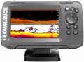 | 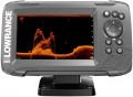 |
|---|---|---|
| Lowrance Hook2 5 SplitShot | Lowrance Hook2 5x GPS SplitShot | |
| Outdated Product | Outdated Product | |
| TOP sellers | ||
| Main | Automatic echo sounder settings. | Automatic echo sounder settings. |
| Type | fish finder-chartplotter | fish finder-chartplotter |
Specs | ||
| Scan depth | 152 m | 152 m |
| Number of beams of radiation | 2 | 2 |
| Number of frequencies | 3 | 3 |
| Radiation frequency | 200/455/800 kHz | 200/455/800 kHz |
| Emitter power | 500 W | 500 W |
| CHIRP Technology | ||
| Bottom scan | ||
Display specs | ||
| Display | 5 " 800x480 px colour backlight | 5 " 800x480 px colour backlight |
Features | ||
| Functions | Sound alarm Determination of the distance to the fish Indication of symbols in the form of fish Real time fish display Shallow/shoal Auto-change depth scale Depth display range Water temperature indicator Speed indication Distance display | Sound alarm Determination of the distance to the fish Indication of symbols in the form of fish Real time fish display Shallow/shoal Auto-change depth scale Depth display range Water temperature indicator Speed indication Distance display |
| Connection interfaces | output for external GPS antenna | output for external GPS antenna |
Specs of the chartplotter | ||
| GPS module | ||
| Base map | ||
| Adding new maps | ||
| Waypoints | 3000 | 1000 |
| Number of routes | 100 | 6 |
General | ||
| Key backlight | ||
| Dust and water protection | ||
| Power source | 12 V | 12 V |
| Dimensions | 185.7x109.8x86.1 mm | 185.7x109.8x86.1 mm |
| Added to E-Catalog | march 2018 | march 2018 |


