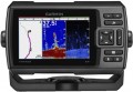
Scan depth
the
maximum depth at which the sonar locator (see "Type") is able to operate effectively — in other words, how deep underwater the device is able to "see".
It is worth choosing an echo sounder according to this parameter, taking into account the actual depths at which it is planned to be used. Of course, this does not place a certain margin, but within reasonable limits (15-20%, less). For example, it hardly makes sense to specially take a model with a scanning depth of 200 m for a lake with pits of 30-40 m — such devices are expensive, while there will simply be nowhere to realize their full potential, and a powerful signal can also scare away the fish. But for marine or oceanic applications, a depth of a kilometer or more may be required; the most advanced echo sounders are quite capable of providing it.
Emitter power
The power output by the fishfinder (or fishfinder-chartplotter, see "Type") when operating.
The
more powerful the emitter, the more “long-range” the device turns out, the greater the depth at which it can work normally (see above). However, do not forget that the practical capabilities of an echo sounder depend on a number of other parameters, ranging from operating frequencies and angles (see above) to the quality of the receiver and the features of signal processing algorithms. In addition, different manufacturers may indicate different types of power in the characteristics: in some cases it is peak (maximum power at the time of a single pulse), in others it is RMS (rms power calculated over a certain period of time and obtained below peak). Therefore, we can say that the role of this parameter is usually purely reference, and when choosing, it is worth focus on moments that are closer to practice (for example, the same scanning depth).
Digital data processing
The presence of a
digital data processing system (DSP) in the design of the echo sounder.
Digital processing allows you to separate the received signal into extraneous noise and useful data. Of course, such a division is not 100% reliable; however, the level of noise in the filtered signal is still significantly reduced, and the screen receives a maximum of useful information and a minimum of extraneous information. The disadvantage of this function is traditional: echo sounders with DSP are somewhat more expensive than usual ones.
Adding new maps
Ability to load new navigation charts into the chartplotter.
This possibility is extremely important in the light of two points. First, the base map (see above) rarely provides the level of detail needed to be used effectively — you have to download more detailed maps of individual areas. Secondly, it is very desirable to update even already loaded maps from time to time, since hydrographic information (depths, currents, shoals, fairway location, etc.) is constantly changing.