Comparison Visuo SG106 vs Visuo XS809HW
Add to comparison | 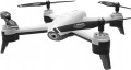 | |
|---|---|---|
| Visuo SG106 | Visuo XS809HW | |
| Outdated Product | Outdated Product | |
| TOP sellers | ||
Gesture control. Additional camera on the bottom of the drone. Object tracking mode. | The model has a folding design, when folded it has dimensions: 190x140x60 mm. Automatic takeoff and landing. The model has three speed modes. The ability to control a smartphone using G-sensor | |
Flight specs | ||
| Maximum flight time | 22 min | 10 min |
Camera | ||
| Camera type | built-in | built-in |
| Number of megapixels | 2 MP | |
| HD filming (720p) | 1280x720 px | 1280x720 px |
| Full HD filming (1080p) | 1920x1080 px 25 fps | |
| Viewing angles | 120° | |
| Live video streaming | ||
| Memory card slot | ||
Flight modes and sensors | ||
| Flight modes | Follow me (tracking) flight plan without GPS (Waypoints) acrobatic mode | return "home" acrobatic mode |
| Sensors | optic gyroscope | heights gyroscope |
Control and transmitter | ||
| Control | remote control and smartphone | remote control and smartphone |
| Gesture control | ||
| Range | 100 m | 80 m |
| Control frequency | 2.4 GHz | 2.4 GHz |
| Video transmission frequency | 2.4 GHz (Wi-Fi) | |
| Smartphone mount | ||
| Remote control power source | 3xAA | |
Motor and chassis | ||
| Number of screws | 4 pcs | 4 pcs |
| Foldable design | ||
Battery | ||
| Battery capacity | 1.6 Ah | 0.9 Ah |
| Voltage | 3.7 В | 3.7 В |
| Battery model | 1S | 1S |
| Batteries in the set | 1 pcs | 1 pcs |
| USB charging | ||
General | ||
| Protected case | ||
| Body backlight | ||
| Material | plastic | plastic |
| Dimensions | 320x320x70 mm | 325x325x60 mm |
| Dimensions (folded) | 190x140x60 mm | |
| Weight | 145 g | 158 g |
| Color | ||
| Added to E-Catalog | november 2019 | november 2017 |
Compare Visuo SG106 and XS809HW
You may be interested in
Visuo SG106 often compared


Visuo XS809HW often compared


Glossary
Maximum flight time
Maximum flight time of a quadcopter on one full battery charge. This indicator is quite approximate, since it is most often indicated for ideal conditions - in real use, the flight time may be less than stated. However, by this indicator it is quite possible to evaluate the general capabilities of the copter and compare it with other models - a longer declared flight time in practice usually means higher autonomy.
Note that for modern copters, a flight time of 20 minutes or more is considered a good indicator, and in the most “long-lasting” models it can exceed 40 minutes.
Note that for modern copters, a flight time of 20 minutes or more is considered a good indicator, and in the most “long-lasting” models it can exceed 40 minutes.
Number of megapixels
Resolution of the matrix in the standard camera of the quadrocopter.
Theoretically, the higher the resolution, the sharper, more detailed image the camera can produce. However, in practice, the quality of the "picture" is highly dependent on a number of other technical features - the size of the matrix, image processing algorithms, optical properties, etc. Moreover, when increasing the resolution without increasing the size of the matrix, the image quality may drop, because. significantly increases the likelihood of noise and extraneous artifacts. And for shooting video, a large number of megapixels is not required at all: for example, to shoot Full HD (1920x1080) video, which is considered a very solid format for quadrocopters, a sensor of only 2.07 megapixels is enough.
Note that high resolution is often a sign of an advanced camera with high image quality. However, this quality is not determined by the number of megapixels, but by the characteristics of the camera and the special technologies used in it. Therefore, when choosing a quadcopter with a camera, you should look not so much at the resolution as at the class and price category of the model as a whole.
Full HD filming (1080p)
The maximum resolution and frame rate supported by the aircraft camera when shooting in Full HD (1080p).
The traditional resolution of such a video is 1920x1080; this is what is most often used in drones, although occasionally there are more specific options — for example, 1280x1080. In general, this is far from the most advanced, but more than a decent high-definition video standard, such an image gives sufficient detail for most cases and looks good even on a large TV screen — 32 "and more. At the same time, achieve a high frame rate in Full HD It is relatively simple and takes up less space than higher resolution content, so Full HD shooting can be done even on aircraft that support more advanced video formats like 4K.
As for the actual frame rate, the higher it is, the smoother the video turns out, the less motion is blurred in the frame. On the other hand, the shooting speed directly affects the requirements for the power of the hardware and the volume of the finished files. In general, values up to 24 fps can be called minimal, from 24 to 30 fps — medium, from 30 to 60 fps — high, and speeds over 60 fps are used mainly for slow motion Full HD.
Viewing angles
The viewing angle provided by the standard quadcopter camera; for optics with adjustable zoom, usually, the maximum value is taken into account.
The viewing angle is the angle between the lines connecting the centre of the lens to the two opposite extreme points of the visible image. Usually measured along the diagonal of the frame, but there may be exceptions. As for the specific values of this parameter, in modern copters they can range from 55 – 60 ° to 180 ° and even more. At the same time, a wider angle (ceteris paribus) allows you to simultaneously fit more space into the frame; and a narrower one covers a smaller space, however, the objects that are in the frame look larger, it is easier to see individual small details on them. So when choosing by this parameter, you should consider what is more important for you: wide coverage or an additional zoom effect.
The viewing angle is the angle between the lines connecting the centre of the lens to the two opposite extreme points of the visible image. Usually measured along the diagonal of the frame, but there may be exceptions. As for the specific values of this parameter, in modern copters they can range from 55 – 60 ° to 180 ° and even more. At the same time, a wider angle (ceteris paribus) allows you to simultaneously fit more space into the frame; and a narrower one covers a smaller space, however, the objects that are in the frame look larger, it is easier to see individual small details on them. So when choosing by this parameter, you should consider what is more important for you: wide coverage or an additional zoom effect.
Memory card slot
The presence of a slot for memory cards in the design of the quadcopter.
Usually, this function is provided in models equipped with cameras (see “Camera type”), and the cards themselves are used primarily for recording captured photos and videos. However, in some models, other data can be stored on such media — GPS tracks, flight routes, flight programs, etc. Anyway, cards are convenient, first of all, by the ability to quickly transfer data between the device and other devices that have a card reader (in particular, laptops).
It is worth noting that different devices can be designed for different standards of memory cards, and the media themselves are usually not supplied in the kit. Therefore, before choosing a card, you should clarify according to official data which type will be optimal for your model.
Flight modes
— Return home function. With this function, the quadcopter can automatically return to the starting point. The specific details of this feature may vary. So, some models return "home" at the user's command, others are able to do it on their own — for example, when the signal from the remote control is lost or when the battery charge is critically low; in many devices, both options are provided at once. Also note that this function is found even in models that do not have a GPS module (see "Sensors") — the copter can navigate in space in another way (by inertial sensors, by a signal from the remote control, etc.).
— Follow me mode. A mode that allows the quadcopter to constantly follow the user at a short distance — like a "personal drone". The way to implement this mode and the equipment required for it can be different: some models track the direction to the transmitter and the signal strength from it, others constantly receive data from the GPS module of a smartphone or other gadget and follow these coordinates, etc. Anyway, such a mode can be useful not only for entertainment, but also for quite practical purposes — for example, for using a quadcopter as an “air chamber”, constantly located next to the operator and at the same time not occupying hands.
— Dronie (distance). Initially, the term “dronie” refers to a selfie (photo or video) taken from a...drone. This mode is mainly intended for such tasks. And its essence lies in the fact that the copter smoothly moves away from a certain object along a given trajectory, keeping this object in the centre of the frame. The classic version of flying in Dronie mode is moving away first horizontally, then horizontally and up; however, in some models, the copter’s trajectory can be further configured. Frame management can also be carried out in different ways — from simple pointing at a certain point and ending with the selection of an object on the screen with further "smart" tracking of this object. Anyway, for all its simplicity, such a shooting technique allows you to create quite interesting videos: for example, in this way you can first capture a group of people in close-up in one video, then the beauty of the landscape around them.
— Rocket (distance up). A flight mode in which the copter smoothly rises to a predetermined altitude along a strictly vertical trajectory. Similar to the Dronie described above, it is mainly used when shooting video: first, a certain scene is shot in close-up, and as it rises, the camera covers an increasingly wider area around this scene. Usually, in Rocket mode, you can pre-set the height at which the device will stop.
— "Orbit mode" (flying in a circle). A mode that allows you to launch the copter in a circular orbit around the specified point. It is also used mainly for shooting video: in such cases, the camera remains constantly pointed at a given object, but the angle and background, due to the movement of the drone, are constantly changing. In the "orbit" settings, usually, you can set its radius, height and direction of movement, as well as the angle of the camera.
— Helix (circle in a spiral). Another mode used as an artistic technique for filming videos. In this mode, the copter, keeping a given object in the centre of the frame, moves around it in a spiral, gradually moving away and increasing its height. This allows you to get the maximum variety of angles and angles of coverage.
Note that Dronie, Rocket, Helix, and Orbit modes originally appeared as part of the proprietary QuickShot toolkit in DJI's Mavic series drones. However, later similar functions were introduced by other manufacturers, so now these names are used as common nouns.
— Flight plan(Waypoints). The ability to set a specific flight route for the quadcopter, by control points. This feature is very similar to the GPS waypoint flyby (see above), but it works differently, without the use of GPS navigation. One of the most popular options is building a route in the smartphone application through which the copter is controlled; when the programme is launched, the smartphone issues a sequence of commands corresponding to the route to the device. In general, the Waypoints mode is not as accurate as a GPS waypoint flyby and offers fewer options. Therefore, this function is mainly for entertainment purposes; if the copter has a camera, it can be useful for taking a selfie or a simple video.
— Flight by GPS points. A mode that allows you to launch a quadcopter along a specific route — by setting individual route points to the car in advance (according to GPS coordinates) and the order in which they are passed. In addition, additional settings may be provided — for example, speed and altitude on individual sections of the route. This function is similar to the Waypoints mode (see below) in many ways, but it is found mainly in mid-range and high-end devices. At the same time, the use of GPS provides higher accuracy, which allows the drone to be used for professional purposes. For example, if you set a route for shooting from the air in this way, the operator will be able to fully concentrate on working with the camera, without being distracted by controlling the copter.
— Acrobatic mode. A special mode for performing aerobatics. Note that the specific meaning of this mode may be different, depending on the level and purpose of the copter. So, in the simplest entertainment models, automatic programs are usually provided that allow you to perform certain aerobatic manoeuvres literally “at the touch of a button”. And in advanced devices in flight mode, the stabilization system is turned off, and the drone is very sensitive to operator commands; this requires high precision in control, but gives maximum control over the flight.
Sensors
Additional sensors provided in the design of the quadcopter.
— Heights. A sensor that determines the flight altitude of the machine. Such sensors can use the barometric or ultrasonic principle of operation. In the first case, the height is measured by the difference in atmospheric pressure between the current point and the starting point (that is, the sensor determines the height relative to the initial level); in the second, the sensor acts similarly to sonar, sending a signal to the ground and measuring the time it takes to return. Barometric sensors are not very accurate, but they work well at high altitudes — tens and hundreds of metres; ultrasonic — on the contrary, they allow you to accurately manoeuvre at low level flight, but lose effectiveness as you climb. However, in some advanced models, both options may be provided at once. Data from the height sensor can either be used by the quadcopter “independently” (for example, when hovering or automatically returning), or transmitted to the operator to the remote control or smartphone.
— Optical. A sensor that allows the quadcopter to "see" the environment in certain directions. One of the simplest variants of such a sensor is a downward-facing camera that allows the device to “copy” the surface under which it flies. Due to this, the machine, for example, can navigate indoors, where the signal from GPS satellites does not reach. In...addition to such a chamber, "eyes" can also be provided from different sides of the machine. Note that optical sensors have certain limitations in their use — for example, they lose their effectiveness on dark, shiny or uniform (without noticeable details) surfaces, as well as at high speeds.
— GPS module. A sensor that receives signals from navigation satellites (GPS, in some models also GLONASS) and determines the current geographical coordinates of the machine. Specific ways of using position data can be different: returning home, flying by waypoints (see below), recording a flight route, etc.
— Gyroscope. A sensor that determines the direction, angle and speed of the machine's rotation along a specific axis. Modern technologies make it possible to create full-fledged three-axis gyroscopes of very compact dimensions, and it is with such modules that quadcopters are usually equipped. On the basis of gyroscopes, automatic stabilization systems usually work, returning the car to a horizontal position after a gust of wind, collision with an obstacle, etc. At the same time, such equipment affects the cost of the device, and in some cases (for example, during piloting), automatic stabilization is more of a hindrance than a useful feature. Therefore, some low-cost, as well as advanced aerobatic quadcopters, are not equipped with gyroscopes.
Range
The range of the drone is the maximum distance from the control device at which a stable connection is maintained and the device remains controlled. For models that allow operation both from the remote control and from a smartphone (see "Control"), this item indicates the maximum value — usually achieved when using the remote control.
When choosing according to this indicator, note that the range is indicated for perfect conditions — within line of sight, without obstacles in the signal path and interference on the air. In reality, the control range may be somewhat lower; and when using a smartphone, it will also depend on the characteristics of a particular gadget. As for specific figures, they can vary from several tens of metres in low-cost models to 5 km or more in high-end equipment. At the same time, it should be said that the greater the range of communication, the higher its reliability in general, the better the control works with an abundance of interference and obstacles. Therefore, a powerful transmitter can be useful not only for long distances, but also for difficult conditions.
When choosing according to this indicator, note that the range is indicated for perfect conditions — within line of sight, without obstacles in the signal path and interference on the air. In reality, the control range may be somewhat lower; and when using a smartphone, it will also depend on the characteristics of a particular gadget. As for specific figures, they can vary from several tens of metres in low-cost models to 5 km or more in high-end equipment. At the same time, it should be said that the greater the range of communication, the higher its reliability in general, the better the control works with an abundance of interference and obstacles. Therefore, a powerful transmitter can be useful not only for long distances, but also for difficult conditions.
Video transmission frequency
The frequency of the radio channel used to transmit the video stream from the camera on board the drone to the receiving device: smartphone or tablet, control panel or pilot’s video glasses. The most common frequencies are 2.4 GHz and 5.8 GHz; video data transmission at a frequency of 1.2 GHz is less common. This parameter directly affects the quality and stability of the video signal, depending on environmental conditions, as well as accompanying interference from other devices. Thus, for receiving video from FPV drones, the most preferable frequency is 5.8 GHz, which is due to a wide selection of channels and high data transfer rates.