Buy DJI Zenmuse L1 Camera and 3-Axis Gimbal DJIZML1
When you make a purchase through links on our site, we may earn an affiliate commission.
DJI Zenmuse L1 Camera and 3-Axis Gimbal DJIZML1
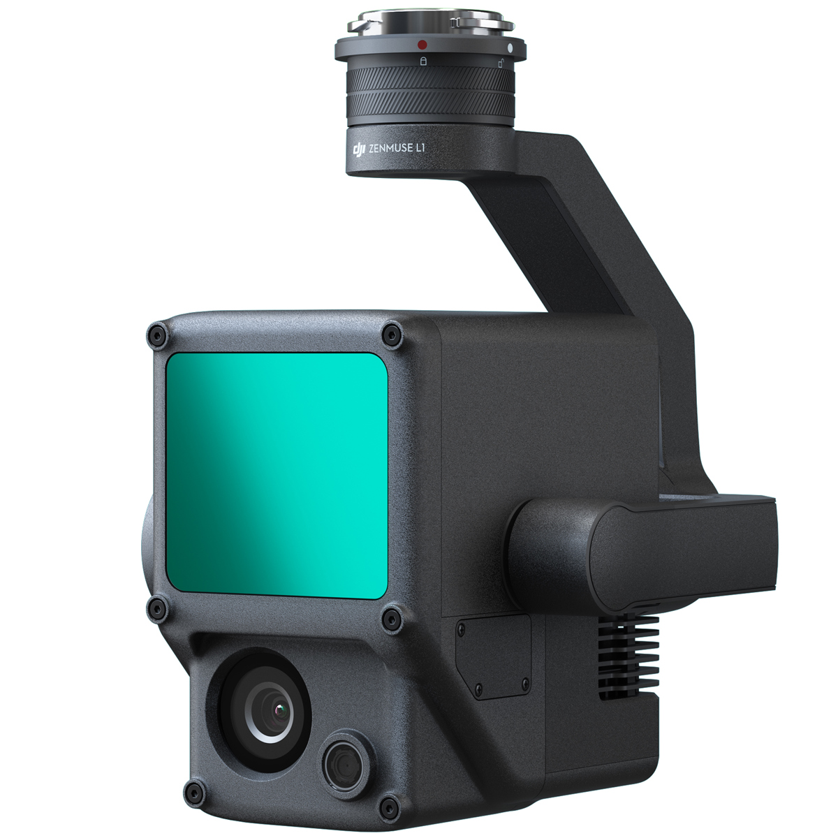
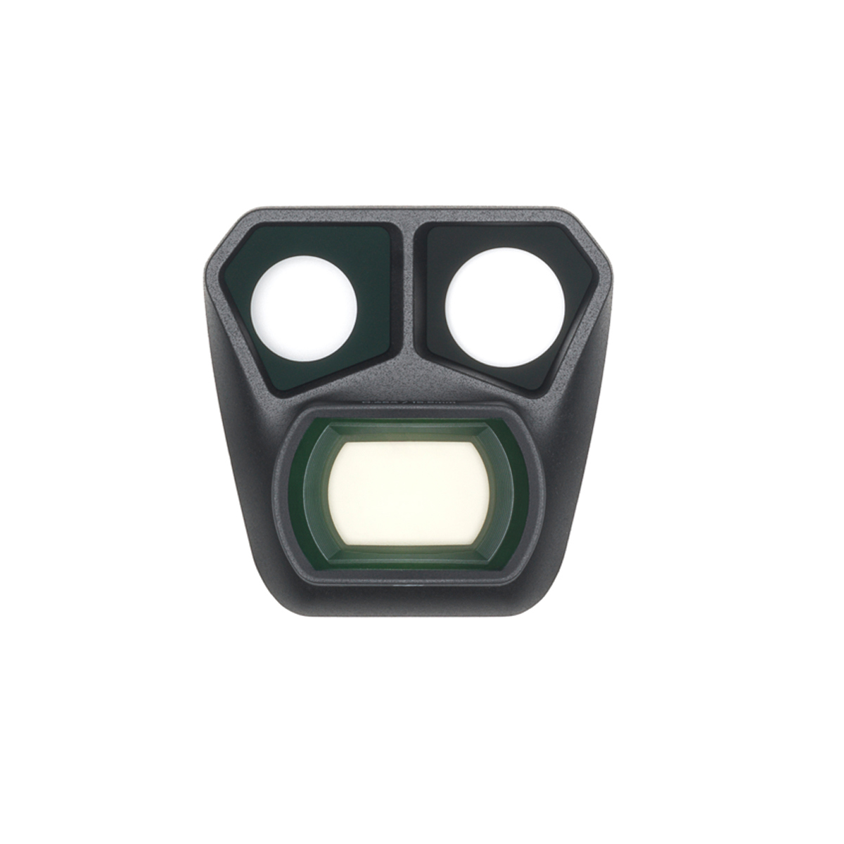
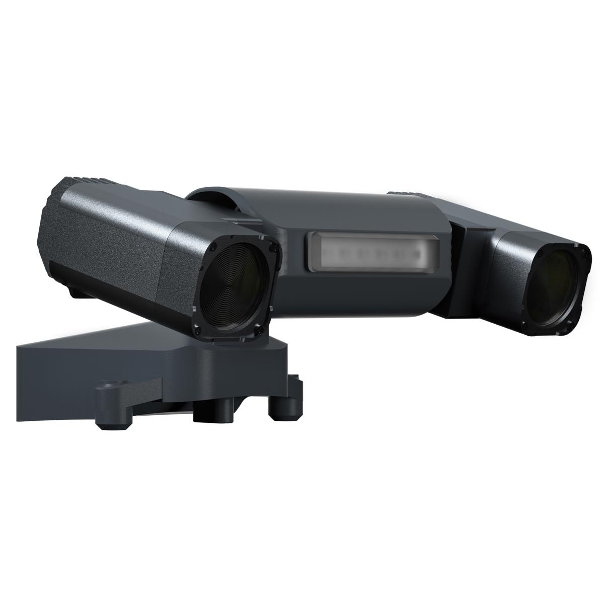
A Lidar + RGB Solution for Aerial SurveyingThe Zenmuse L1 integrates a Livox Lidar module, a high-accuracy IMU, and a camera with a 1-inch CMOS on a 3-axis stabilized gimbal. When used with Matrice 300 RTK and DJI Terra, the L1 forms a complete solution that gives you real-time 3D data throughout the day, efficiently capturing the details of comple... morex structures and delivering highly accurate reconstructed models.Digitize without CompromiseExceptional EfficiencyGenerate true-color point cloud models in real-time, or acquire 2 km2 of point cloud data in a single flight using the Livox frame Lidar module with a 70 Degree FOV and a visible light camera with a 1-inch sensor.Unparalleled AccuracyRender centimeter-accurate reconstructions thanks to the high-accuracy IMU, a vision sensor for positioning accuracy, and the incorporation of GNSS data.Ready When You AreThe IP44 rating allows the L1 to be operated in rainy or foggy environments. The Lidar module's active scanning method enables you to fly at night.Visualize Data as You FlyLivox Lidar Module• Frame Lidar with up to 100% effective point cloud results• Detection Range: 450m (80% reflectivity, 0 klx) / 190 m (10% reflectivity, 100 klx)• Effective Point Rate: 240,000 pts/s• Supports 3 Returns• Line Scan Mode and Non-repetitive Scan ModeEverything in View RGB Camera• 20MP• 1-inch CMOS• Mechanical ShutterAccurate Details at Your Disposal High-accuracy IMUAccuracy: 0.025 Degree (roll/pitch) / 0.08 Degree (yaw)• Vision Sensor for Positioning Accuracy• GNSS, IMU, RGB Data FusionRecreate the World in 3D Point CloudsPoint Cloud LiveViewReal-time point clouds provide immediate insights onsite, so operators are informed to make critical decisions quickly. You can also verify fieldwork quality by checking point cloud data immediately after each flight.Measurement and AnnotationAcquire and communicate critical dimensions on the point cloud model using measurements and annotations.One-stop Post-processingDJI Terra fuses the IMU and GNSS data for point cloud and visible light calculations, in addition to conducting POS data calculations so you can effortlessly generate reconstructed models and accuracy reports.
A Lidar + RGB Solution for Aerial SurveyingThe Zenmuse L1 integrates a Livox Lidar module, a high-accuracy IMU, and a camera with a 1-inch CMOS on a 3-axis stabilized gimbal. When used with Matrice 300 RTK and DJI Terra, the L1 forms a complete solution that gives you real-time 3D data throughout the day, efficiently capturing the details of comple... morex structures and delivering highly accurate reconstructed models.Digitize without CompromiseExceptional EfficiencyGenerate true-color point cloud models in real-time, or acquire 2 km2 of point cloud data in a single flight using the Livox frame Lidar module with a 70 Degree FOV and a visible light camera with a 1-inch sensor.Unparalleled AccuracyRender centimeter-accurate reconstructions thanks to the high-accuracy IMU, a vision sensor for positioning accuracy, and the incorporation of GNSS data.Ready When You AreThe IP44 rating allows the L1 to be operated in rainy or foggy environments. The Lidar module's active scanning method enables you to fly at night.Visualize Data as You FlyLivox Lidar Module• Frame Lidar with up to 100% effective point cloud results• Detection Range: 450m (80% reflectivity, 0 klx) / 190 m (10% reflectivity, 100 klx)• Effective Point Rate: 240,000 pts/s• Supports 3 Returns• Line Scan Mode and Non-repetitive Scan ModeEverything in View RGB Camera• 20MP• 1-inch CMOS• Mechanical ShutterAccurate Details at Your Disposal High-accuracy IMUAccuracy: 0.025 Degree (roll/pitch) / 0.08 Degree (yaw)• Vision Sensor for Positioning Accuracy• GNSS, IMU, RGB Data FusionRecreate the World in 3D Point CloudsPoint Cloud LiveViewReal-time point clouds provide immediate insights onsite, so operators are informed to make critical decisions quickly. You can also verify fieldwork quality by checking point cloud data immediately after each flight.Measurement and AnnotationAcquire and communicate critical dimensions on the point cloud model using measurements and annotations.One-stop Post-processingDJI Terra fuses the IMU and GNSS data for point cloud and visible light calculations, in addition to conducting POS data calculations so you can effortlessly generate reconstructed models and accuracy reports.
A Lidar + RGB Solution for Aerial SurveyingThe Zenmuse L1 integrates a Livox Lidar module, a high-accuracy IMU, and a camera with a 1-inch CMOS on a 3-axis stabilized gimbal. When used with Matrice 300 RTK and DJI Terra, the L1 forms a complete solution that gives you real-time 3D data throughout the day, efficiently capturing the details of complex structures and delivering highly accurate reconstructed models.Digitize without CompromiseExceptional EfficiencyGenerate true-color point cloud models in real-time, or acquire 2 km2 of point cloud data in a single flight using the Livox frame Lidar module with a 70 Degree FOV and a visible light camera with a 1-inch sensor.Unparalleled AccuracyRender centimeter-accurate reconstructions thanks to the high-accuracy IMU, a vision sensor for positioning accuracy, and the incorporation of GNSS data.Ready When You AreThe IP44 rating allows the L1 to be operated in rainy or foggy environments. The Lidar module's active scanning method enables you to fly at night.Visualize Data as You FlyLivox Lidar Module• Frame Lidar with up to 100% effective point cloud results• Detection Range: 450m (80% reflectivity, 0 klx) / 190 m (10% reflectivity, 100 klx)• Effective Point Rate: 240,000 pts/s• Supports 3 Returns• Line Scan Mode and Non-repetitive Scan ModeEverything in View RGB Camera• 20MP• 1-inch CMOS• Mechanical ShutterAccurate Details at Your Disposal High-accuracy IMUAccuracy: 0.025 Degree (roll/pitch) / 0.08 Degree (yaw)• Vision Sensor for Positioning Accuracy• GNSS, IMU, RGB Data FusionRecreate the World in 3D Point CloudsPoint Cloud LiveViewReal-time point clouds provide immediate insights onsite, so operators are informed to make critical decisions quickly. You can also verify fieldwork quality by checking point cloud data immediately after each flight.Measurement and AnnotationAcquire and communicate critical dimensions on the point cloud model using measurements and annotations.One-stop Post-processingDJI Terra fuses the IMU and GNSS data for point cloud and visible light calculations, in addition to conducting POS data calculations so you can effortlessly generate reconstructed models and accuracy reports.
Product description is based on database from online stores. Be sure to verify all information directly with seller before purchasing.
This website uses cookies. Proceeding to use this website gives your consent for gathering and processing your data for analytic and marketing purposes.