Comparison Navitel E505 Magnetic vs Navitel E500
Add to comparison | 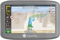 | 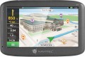 |
|---|---|---|
| Navitel E505 Magnetic | Navitel E500 | |
from $127.36 | from $84.00 | |
| User reviews | ||
| TOP sellers | ||
Magnetic mount with power through. Numerous pre-installed maps. | ||
| Application area | cars | cars |
Software | ||
| Pre-installed soft | Navitel Navigator | Navitel Navigator |
Receiver | ||
| Bands number | 66 | |
Display specs | ||
| Display | 5 " 480x272 px touch | 5 " 800х480 px touch |
Additional equipment | ||
| More features | video player image display MP3 player | video player image display MP3 player |
| CPU speed | 800 MHz | 800 MHz |
| RAM | 128 MB | 128 MB |
| Built-in memory | 8 GB | |
Connections | ||
| Interfaces | USB memory card slot headphone output | USB headphone output |
| Max. memory card / flash drive size | 32 GB | |
General | ||
| Power supply | rechargeable battery | rechargeable battery |
| Battery capacity | 800 mAh | 950 mAh |
| Magnetic mount | ||
| Dimensions (HxWxT) | 89x132x17.5 mm | |
| Weight | 161 g | |
| Added to E-Catalog | june 2019 | january 2017 |
Compare Navitel E505 Magnetic and E500
You may be interested in
My comparisons
Navitel E500 often compared


Glossary
Bands number
The number of communication channels supported by the navigator.
One communication channel allows the device to receive one operating frequency from one satellite. Without going into unnecessary details, we can say that the greater the number of channels, the more efficient the navigator works (including in dense urban areas and other adverse conditions) and the less time it takes for a “cold” start. On the other hand, numerous supported frequencies complicates the receiver and increases its cost.
As for the specific number, 12 channels are needed to work effectively with GPS, but today such receivers are considered obsolete and are almost never used. Most low-cost receivers support about 20 channels (there are also more modest solutions, at 16 or even 14 frequencies), mid-range solutions have about 30 – 40 channels, and in advanced models this number is most often 64 or 66 (although sometimes more) .
Display
Parameters of the display installed in the navigator.
— Display diagonal. Size screen size in inches. The larger the screen, the more information can be displayed on it and the more detailed this information will be presented. On the other hand, the size of the display significantly affects the dimensions of the device, and large screens are more expensive.
— Display resolution. Display size in dots (pixels) horizontally and vertically. The higher the resolution (with the same diagonal), the more detailed and clear the image the screen can produce. In addition, on high-resolution displays, small details are better visible, which increases the comfort of viewing information. Too high a resolution is usually not required for GPS navigator displays: for example, 800x480 pixels, limited by the standards of smartphones or tablets, with a diagonal screen size of about 6” are considered quite sufficient even for an advanced device.
— Matrix type. This parameter is indicated mainly for tech cases when the screen uses a high-quality IPS type matrix. This technology provides high quality color rendering, good brightness and wide viewing angles; moreover, IPS screens are relatively inexpensive to produce.
- Touch. Screen support for touch control. You can give commands to the device by touching the icons on the display itself - similar to how this is done in smartphones and tablets. Touch control opens up...many more possibilities than classic controls and provides flexibility in working with the navigator. In particular, by touching the screen you can set points on the route, zoom in or out on the map, etc.
- Color. This parameter determines whether the screen is color or monochrome (black and white). Black and white displays are simple, inexpensive, consume little power, and are quite suitable for displaying basic navigation information. At the same time, color screens are more functional: maps often use different colors to highlight individual objects, which would not be possible on monochrome displays. As a result, black and white screens are quite rare among modern navigators - mainly among the most compact and inexpensive models.
— Backlight. The screen has its own backlight system. This function makes the device independent of external lighting: the illuminated image will be normally visible both at dusk and even in complete darkness. It is also worth noting that many LCD screens have a backlight by default; it is activated when the screen itself is turned on and works regardless of external lighting - without it, the image on the matrix would simply be impossible to see. In particular, this operating principle is used in IPS-type matrices, which have gained popularity in modern portable electronics (including navigators).
Built-in memory
The amount of built-in memory installed in the navigator.
The amount of data that can be stored in the device directly depends on this indicator. However, it is worth keeping in mind that, on the one hand, a certain amount of built-in memory will inevitably be occupied by the operating system (if there is one), firmware and other programs supplied in the kit; on the other hand, the set of these programs in most cases also includes a preinstalled card. The latter means that the navigator can be used for its intended purpose “out of the box” without installing additional software; and for such an application the built-in memory is guaranteed to be enough. This means that it makes sense to pay attention to the storage capacity primarily if the device will have to work with additional data - from extended maps to photos and videos. This is especially true for models with a full-fledged OS like Windows or Android, which allows the installation of additional applications.
The amount of data that can be stored in the device directly depends on this indicator. However, it is worth keeping in mind that, on the one hand, a certain amount of built-in memory will inevitably be occupied by the operating system (if there is one), firmware and other programs supplied in the kit; on the other hand, the set of these programs in most cases also includes a preinstalled card. The latter means that the navigator can be used for its intended purpose “out of the box” without installing additional software; and for such an application the built-in memory is guaranteed to be enough. This means that it makes sense to pay attention to the storage capacity primarily if the device will have to work with additional data - from extended maps to photos and videos. This is especially true for models with a full-fledged OS like Windows or Android, which allows the installation of additional applications.
Interfaces
— Wi-Fi. A technology originally designed to connect to the Internet through wireless access points; for the same purpose, Wi-Fi is most often used in navigators. Note that not only a stationary router can play the role of an access point, but also a smartphone — many of these gadgets have the appropriate mode. But the specific possibilities of such a connection may be different. One of the most popular features is downloading up-to-date traffic data and other traffic information (see "Features"). In addition, navigators may provide updating maps and firmware via the Internet. And for models with full-fledged OS (see "Operating System"), the ways of using Wi-Fi are very diverse: web surfing, access to social networks and instant messengers, "social" games that involve communication with other players, etc. In fact , in navigators with OS, Wi-Fi capabilities are limited only by the set of installed applications.
— USB. The device has a USB connector. Most often, modern navigators are equipped with compact ports like miniUSB or microUSB, and the main purpose of such ports is to charge the battery and connect to a computer — for example, to update maps. The most advanced models may also provide the connection of external peripherals (for example, a flash drive with map updates or a 3G modem for Internet access), but such features are quite rare, mainly among navigators with a full-fledged OS (see "Opera...ting system").
— Slot for memory cards. A device for reading removable memory cards — most often in the SD or microSD form factor; specific types of supported cards should be specified separately. Such a device (card reader) performs two main functions. Firstly, it allows you to expand the built-in memory of the navigator by supplementing it with external media; at the same time, the capacity of the card can be chosen at your discretion (taking into account the maximum volume — see below). Secondly, the card reader facilitates the exchange of data with other devices — smartphones, tablets, laptops, etc.; this can be useful, for example, for loading maps and other navigation data, for copying recorded tracks, etc. The specific functionality of the card reader should be specified separately.
— Headphone output. The presence in the navigator of a special connector for connecting headphones. Usually the role of such an output is played by a standard 3.5 mm port. Headphones can be used for any tasks related to sound accompaniment — voice prompts, talking on the phone or via the Internet (via Skype, Viber, etc.), listening to music and watching videos, etc. (depending on which functions are provided in the navigator itself). At the same time, the “ears” are especially convenient in two situations: in a noisy environment, when the speaker of the navigator may not be heard over background sounds, and also when it is desirable to avoid unnecessary sounds (for example, if passengers are sleeping in the car).
— Bluetooth. A wireless communication technology designed to connect different devices directly to each other. The method of using such a connection can be different, one of the most popular options in navigators is connecting a wireless headset. Through such a headset, you can hear the voice prompts of the navigator and give commands to it, talk on the phone, listen to music, etc. (specific possibilities, of course, depend on the functionality of the navigator itself). However headsets are more expensive than wired headphones and have a limited operating time (the battery needs to be charged periodically); but they are much more comfortable.
— ANT+. This standard is mainly used to transmit information of a sports and medical nature — heart rate, distance traveled, speed, etc. It is characterized by low power consumption, but has a low bandwidth — up to 60 kbps. For ANT + to work, it must be supported not only by the gadget, but also by the smartphone or other device to which it is connected. At the same time, we note that, in addition to a direct connection to an external device, this standard allows you to build networks from ANT +-compatible devices — including integrate them into smart home systems.
— AV input. Input for connecting a composite (audio + video) analogue signal. With such an input, you can connect an external signal source to the navigator, such as a portable DVD player, a reversing camera (in car navigators), an echo sounder (in marine ones), etc.
Max. memory card / flash drive size
The maximum size of a memory card or USB-drive (flash drive) supported by the navigator.
Removable media can be used for different purposes: downloading maps and software updates, uploading tracks you have covered, playing or copying music and movies (in models with the appropriate capabilities), etc. Specific options for using such media for each model should be clarified separately. And the restrictions on volume are primarily due to the fact that more capacious memory cards and flash drives require more powerful hardware. So you should not exceed this limit: at best, the drive will not work correctly, at worst, hardware failures are possible.
Removable media can be used for different purposes: downloading maps and software updates, uploading tracks you have covered, playing or copying music and movies (in models with the appropriate capabilities), etc. Specific options for using such media for each model should be clarified separately. And the restrictions on volume are primarily due to the fact that more capacious memory cards and flash drives require more powerful hardware. So you should not exceed this limit: at best, the drive will not work correctly, at worst, hardware failures are possible.
Battery capacity
This parameter directly determines the amount of energy that the battery can store; and the greater the energy reserve, the longer the device can work on one battery charge. However, this is in theory; in practice the situation is somewhat more complicated. Firstly, the actual autonomy of the navigator will also depend on the power consumption of the device - and it can vary greatly between different models. Secondly, milliamp-hours, in which capacity is indicated, is not a completely reliable unit: the physical features of such a designation are such that two batteries with the same capacity in mAh, but different nominal voltages, will also have different actual amounts of stored energy.
In light of all this, it is hardly worth assessing the autonomy of the navigator by the capacity of the included battery - it is better to look at the operating time directly stated by the manufacturer.
In light of all this, it is hardly worth assessing the autonomy of the navigator by the capacity of the included battery - it is better to look at the operating time directly stated by the manufacturer.
Magnetic mount
The device holder is in the form of a permanent powerful magnet, the strength of which is sufficient to hold the navigator in place. To install the device on such a clamp, it is enough to “stick” the navigator to the magnetic pad, and to remove it, pull it firmly. Magnetic mounts are very easy to use, reliable and durable due to the absence of moving parts in the design.