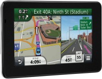
Garmin Nuvi 3590LMT
 | Outdated Product This car navigator model has a very rich set of functions and will satisfy the needs of the most demanding car enthusiast. The device itself will create a route, remember up to 100 previously laid routes and, if necessary, retrieve it from memory, lay up to 1000 waypoints on the route. Comes with a lifetime subscription for free map updates for Europe. Maps of other areas can be loaded via USB or memory stick. E-Catalog uses affiliate links compensated by our partners. |
We recommend products in stockSat Navs Garmin →

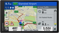

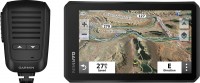
trucks, 7 ", memory 16 GB, Live Traffic, Lane Guidance, Wi-Fi, magnetic mount, up to 2 hours of work, 242 g
motorcycle, 5.5 ", memory 32 GB, Live Traffic, Lane Guidance, Wi-Fi, ANT+, water protection IPX7, up to 6 hours of work, 262 g
trucks, 6.95 ", memory 32 GB, Lane Guidance, dashcam, Wi-Fi, up to 1 hours of work, 242 g
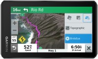
motorcycle, 6 ", memory 32 GB, Live Traffic, Lane Guidance, GPS informer, Wi-Fi, ANT+, water protection IPX7, up to 7 hours of work, 340 g
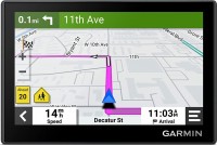
cars, 6.95 ", memory 64 GB, Live Traffic, Lane Guidance, Wi-Fi, water protection IPX7, up to 3 hours of work, 437 g
trucks, 6.95 ", memory 16 GB, Lane Guidance, dashcam, Wi-Fi, up to 0.5 hours of work, 271 g
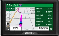
cars, 5.5 ", memory 32 GB, Live Traffic, Lane Guidance, Wi-Fi, water protection IPX7, up to 6 hours of work, 262 g

cars, 6 ", memory 64 GB, Live Traffic, Lane Guidance, Wi-Fi, ANT+, water protection IPX7, up to 7 hours of work, 340 g
Garmin Nuvi 3590LMT
Type:cars
Screen size:5 "
Resolution:800х480 px
Interfaces:Bluetooth
Working hours:up to 4 h
Weight:203 g
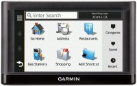
This car navigator model has a very rich set of functions and will satisfy the needs of the most demanding car enthusiast. The device itself will create a route, remember up to 100 previously laid routes and, if necessary, retrieve it from memory, lay up to 1000 waypoints on the route. Comes with a lifetime subscription for free map updates for Europe. Maps of other areas can be loaded via USB or memory stick.
All specifications
Specifications Nuvi 3590LMT
|
| |||||||||||||||||||||||||||||||||||||||||||||||||||||||||||||||
The information in the model description is for reference purposes.
Always clarify the specifications and configuration of the product with the online store manager before purchasing.
Catalog Garmin 2026 - new arrivals, bestsellers, and the most relevant models Garmin.
Always clarify the specifications and configuration of the product with the online store manager before purchasing.
Catalog Garmin 2026 - new arrivals, bestsellers, and the most relevant models Garmin.
Series Garmin Nuvi (car)Compare using chart →
Model overview based on user reviews
The Garmin Nuvi 3590LMT is a highly regarded GPS navigator for cars, praised for its voice control, 3D building maps, and efficient traffic updates. Users appreciate its high-quality casing and bright, anti-glare display, which remains visible even in sunlight. The device is noted for its fast route recalculations and quarterly free map updates. While the navigator performs excellently in Europe, some users report issues with maps in Ukraine and Russia. Despite a slightly high price, the Garmin Nuvi 3590LMT is considered a multifunctional and reliable device for both city and long-distance travel.
Pros
Cons
0 0 1 3 |
i advise you to take 3590 LMT and save 800 UAH. and not have a map of Europe, a video, an MP3 player and, of course, information about traffic jams. Bought on Lev Tolstoy Street 51/102 advantages: -voice control, convenient and uplifting :) -3D buildings and map really help to understand where you are. -traffic saved me in Germany, otherwise I would have been stuck. -charging in the stand is a + even ++ -anti-glare is just awesome, the sun is shining, and it's happy. -The ecoRoute function really works. -the battery lasts 3-3.5 hours with constant use. the screen collapses in a couple of touches, it’s worth purchasing a special cloth. |
If the price doesn't scare you, you should take it! This is not my first navigator and I have something to compare it with. Of course, Garmin is at its best compared to other manufacturers. They made a very nice device. The sensitivity of the receiver is excellent. Fine. It plots a route without a brake, and if I’m driving through traffic jams, it quickly recalculates the route. Recognizes speech normally when I use voice control. Shows diagrams of exits from highways - now you won’t be mistaken about where exactly to turn off. Maps must be updated quarterly. I'll see, they seem to promise that this is a simple procedure (I've only been using it for a little over a month so far). not found |
I've been using it for almost a year. Never regretted buying it. It's fast, pleasant to hold. It performs its functions properly. Add free traffic updates, map updates every three months (also free), and a 2-year warranty - and you get a decent gadget for city trips and longer journeys. High-quality casing, materials. Large screen, bright display. The speed of operation pleased me. Convenient features include: - voice control, - detailed maps with 3D junctions and intersections, - ability to zoom in and out of objects, - builds routes quickly and adequately The price is a little overpriced in my opinion. |
3 out of 4 user review(s) shown
1 more user review(s)
Additional features sat nav Garmin Nuvi 3590LMT:
- trafficTrends
- myTrends
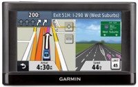
- Junction view function will display a realistic image of the intersection
- Split screen
- Support for Garmin services
- Adding POIs
- Combining multiple destinations to get the best route