Garmin GPSMAP 76CSx
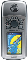 | Outdated Product Hiking GPS navigator with barometric altimeter and electronic compass. True, the use of the latter can significantly reduce the battery life of the navigator. Regular operating time from a set of two AA batteries is at least 18 hours. The case of the navigator has a good level of water protection, it can be used even during heavy rain and dropped into puddles. The receiver for GPS signals is assembled on the basis of a 12-channel SIRF III chip. E-Catalog uses affiliate links compensated by our partners. |
We recommend products in stockSat Navs Garmin →
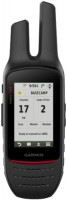
handheld, 2.6 ", water protection IPX7, non chargeable batteries, up to 20 hours of work, 260 g
handheld, 2.6 ", water protection IPX7, non chargeable batteries, up to 18 hours of work, 203 g
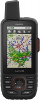
handheld, 3 ", memory 8 GB, water protection IPX7, non chargeable batteries, up to 19 hours of work, 282 g
handheld, 2.6 ", memory 16 GB, ANT+, water protection IPX7, non chargeable batteries, up to 16 hours of work, 217 g
handheld, 2.6 ", memory 16 GB, ANT+, water protection IPX7, non chargeable batteries, up to 16 hours of work, 217 g

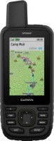
handheld, 3 ", memory 16 GB, Wi-Fi, ANT+, water protection IPX7, up to 180 hours of work, 230 g
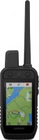
handheld, 3 ", memory 4 GB, Wi-Fi, ANT+, water protection IPX7, up to 18 hours of work, 272 g

handheld, 3 ", memory 16 GB, Wi-Fi, ANT+, water protection IPX7, up to 35 hours of work, 230 g
handheld, 3 ", memory 16 GB, Wi-Fi, ANT+, water protection IPX7, up to 180 hours of work, 230 g

handheld, 3.5 ", memory 16 GB, Wi-Fi, ANT+, water protection IPX7, up to 55 hours of work, 280 g
handheld, 3.5 ", memory 16 GB, Wi-Fi, ANT+, water protection IPX7, up to 55 hours of work, 280 g
Garmin GPSMAP 76CSx
Type:handheld
Screen size:2.7 "
Resolution:160х240 px
Power supply:non chargeable battery
Working hours:up to 18 h
Weight:218 g
Hiking GPS navigator with barometric altimeter and electronic compass. True, the use of the latter can significantly reduce the battery life of the navigator. Regular operating time from a set of two AA batteries is at least 18 hours. The case of the navigator has a good level of water protection, it can be used even during heavy rain and dropped into puddles. The receiver for GPS signals is assembled on the basis of a 12-channel SIRF III chip.
All specifications
Specifications GPSMAP 76CSx
|
| |||||||||||||||||||||||||||||||||||||||||||||||||||||||||||
The information in the model description is for reference purposes.
Always clarify the specifications and configuration of the product with the online store manager before purchasing.
Catalog Garmin 2026 - new arrivals, bestsellers, and the most relevant models Garmin.
Always clarify the specifications and configuration of the product with the online store manager before purchasing.
Catalog Garmin 2026 - new arrivals, bestsellers, and the most relevant models Garmin.
Series Garmin GPSMAP (tracking)Compare using chart →
handheld, 3 ", memory 16 GB, Wi-Fi, ANT+, water protection IPX7, up to 180 hours of work, 230 g
handheld, 2.6 ", memory 16 GB, ANT+, water protection IPX7, non chargeable batteries, up to 16 hours of work, 217 g
handheld, 2.6 ", memory 16 GB, ANT+, water protection IPX7, non chargeable batteries, up to 16 hours of work, 217 g
handheld, 3 ", memory 8 GB, water protection IPX7, non chargeable batteries, up to 19 hours of work, 282 g
handheld, 3 ", memory 16 GB, Wi-Fi, ANT+, water protection IPX7, up to 180 hours of work, 230 g
handheld, 3 ", memory 4 GB, Wi-Fi, ANT+, water protection IPX7, up to 18 hours of work, 272 g
handheld, 2.6 ", water protection IPX7, non chargeable batteries, up to 20 hours of work, 260 g
handheld, 2.6 ", water protection IPX7, non chargeable batteries, up to 18 hours of work, 203 g
handheld, 3 ", memory 16 GB, Wi-Fi, ANT+, water protection IPX7, up to 35 hours of work, 230 g
Additional features sat nav Garmin GPSMAP 76CSx:
The Garmin GPSMAP 76CSx, thanks to its highly sensitive GPS receiver, provides fast satellite reception and reliable positioning even in difficult conditions (under dense canopy or in a deep ravine). The built-in electronic compass allows you to get azimuth readings even when stationary. The barometric altimeter tracks changes in pressure for accurate altitude measurements. In addition, you can use the altimeter to graph barometric or atmospheric pressure over time for weather forecasting. The 76CSx's bright TFT colour display provides excellent image quality in any light level.
The Garmin GPSMAP 76CSx ships with an empty 128 megabyte (MB) microSD card that is used to store additional maps or other data. The microSD card slot is located inside the sealed battery compartment. During road navigation, the 76CSx provides turn-by-turn directions to your chosen destination. It also accepts memory cards pre-loaded with MapSource® information for land and sea travel.
- Self-installation of POI points
- Geocaching Mode
- Possibility to update the firmware
- Hunter/fisher calendar
- Sunrise/sunset and moon phase information
- Tide table
- Area calculation
- Electronic compass
- Strap
- USB cable
- Memory card 128 MB microSD
- MapSource® Trip & Waypoint Manager CD
- Brief instruction
- User guide
- Garmin GPSMAP 76CSx — built-in electronic compass, barometric altimeter (altimeter)
- Garmin GPSMAP 76Cx — no built-in electronic compass, barometric altimeter (altimeter)
The Garmin GPSMAP 76CSx, thanks to its highly sensitive GPS receiver, provides fast satellite reception and reliable positioning even in difficult conditions (under dense canopy or in a deep ravine). The built-in electronic compass allows you to get azimuth readings even when stationary. The barometric altimeter tracks changes in pressure for accurate altitude measurements. In addition, you can use the altimeter to graph barometric or atmospheric pressure over time for weather forecasting. The 76CSx's bright TFT colour display provides excellent image quality in any light level.
The Garmin GPSMAP 76CSx ships with an empty 128 megabyte (MB) microSD card that is used to store additional maps or other data. The microSD card slot is located inside the sealed battery compartment. During road navigation, the 76CSx provides turn-by-turn directions to your chosen destination. It also accepts memory cards pre-loaded with MapSource® information for land and sea travel.