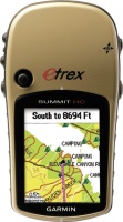
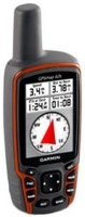
Garmin eTrex Summit HC
 | Outdated Product This portable GPS navigator will be useful for those who do not need numerous maps and for whom the presence of an altimeter and an electronic compass is much more important. The machine's memory is 24 MB and cannot be expanded using memory cards. You can use the USB interface to update maps of the area. The device is assembled in an ergonomic waterproof case and is easily operated with one hand. The screen glass is very difficult to scratch. E-Catalog uses affiliate links compensated by our partners. |
We recommend products in stockSat Navs Garmin →
handheld, 2.6 ", water protection IPX7, non chargeable batteries, up to 20 hours of work, 218 g
handheld, 2.6 ", memory 16 GB, ANT+, water protection IPX7, non chargeable batteries, up to 16 hours of work, 217 g
handheld, 2.6 ", water protection IPX7, non chargeable batteries, up to 16 hours of work, 260 g
handheld, 2.2 ", memory 3.7 GB, water protection IPX7, non chargeable batteries, up to 25 hours of work, 142 g
handheld, 2.6 ", water protection IPX7, non chargeable batteries, up to 20 hours of work, 260 g
handheld, 2.2 ", memory 8 GB, ANT+, water protection IPX7, non chargeable batteries, up to 25 hours of work, 142 g
wrist-mounted, 2.2 ", ANT+, water protection IPX7, non chargeable batteries, up to 100 hours of work, 108 g
wrist-mounted, 1.7 ", water protection IPX7, non chargeable batteries, up to 17 hours of work, 87 g

handheld, 2.6 ", water protection IPX7, non chargeable batteries, up to 16 hours of work, 260 g
handheld, 2.6 ", memory 16 GB, ANT+, water protection IPX7, non chargeable batteries, up to 16 hours of work, 217 g
Garmin eTrex Summit HC
Type:handheld
Screen size:1.7 "
Resolution:176x220 px
Power supply:non chargeable battery
Working hours:up to 14 h
Weight:156 g
This portable GPS navigator will be useful for those who do not need numerous maps and for whom the presence of an altimeter and an electronic compass is much more important. The machine's memory is 24 MB and cannot be expanded using memory cards. You can use the USB interface to update maps of the area. The device is assembled in an ergonomic waterproof case and is easily operated with one hand. The screen glass is very difficult to scratch.
All specifications
Specifications eTrex Summit HC
|
| |||||||||||||||||||||||||||||||||||||||||||||||||||||||
The information in the model description is for reference purposes.
Always clarify the specifications and configuration of the product with the online store manager before purchasing.
Catalog Garmin 2026 - new arrivals, bestsellers, and the most relevant models Garmin.
Always clarify the specifications and configuration of the product with the online store manager before purchasing.
Catalog Garmin 2026 - new arrivals, bestsellers, and the most relevant models Garmin.
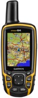
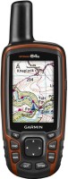
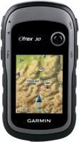
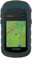
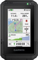
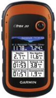
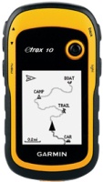
Series Garmin eTrex (handheld)Compare using chart →
handheld, 2.2 ", memory 8 GB, ANT+, water protection IPX7, non chargeable batteries, up to 25 hours of work, 142 g
handheld, 2.2 ", water protection IPX7, non chargeable batteries, up to 168 hours of work, 157 g
handheld, 2.2 ", memory 8 GB, water protection IPX7, non chargeable batteries, up to 25 hours of work, 142 g
handheld, 2.2 ", water protection IPX7, non chargeable batteries, up to 25 hours of work, 142 g
handheld, 2.2 ", water protection IPX7, non chargeable batteries, up to 25 hours of work, 142 g
handheld, 2.2 ", memory 3.7 GB, water protection IPX7, non chargeable batteries, up to 25 hours of work, 142 g
Additional features sat nav Garmin eTrex Summit HC:
WAAS technology
WAAS (Wide Area Augmentation System) is a system designed to increase the accuracy of satellite navigation instruments. The principle of operation of the system is based on the correction of satellite data with the help of special corrections, which are calculated by base stations installed in the service area of the system.
- WAAS technology
- Strap
- USB cable
- MapSource® Trip & Waypoint Manage Software
WAAS technology
WAAS (Wide Area Augmentation System) is a system designed to increase the accuracy of satellite navigation instruments. The principle of operation of the system is based on the correction of satellite data with the help of special corrections, which are calculated by base stations installed in the service area of the system.