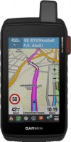
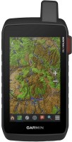
Garmin Montana 650t
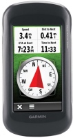 | Outdated Product $568.00 A serious device for travelers and just outdoor enthusiasts. The navigator can operate both from the built-in battery and from a set of AA batteries, in the latter case, the operating time is up to 22 hours. The 4" colour touch screen of the device has a resolution of 480x272 pixels. The body is waterproof at IPX7, it is possible to connect an external antenna. There is even a digital camera with autofocus. |
Garmin Montana 650t
Type:handheld
Screen size:4 "
Resolution:480x272 px
Working hours:up to 16 h
Weight:289 g
A serious device for travelers and just outdoor enthusiasts. The navigator can operate both from the built-in battery and from a set of AA batteries, in the latter case, the operating time is up to 22 hours. The 4" colour touch screen of the device has a resolution of 480x272 pixels. The body is waterproof at IPX7, it is possible to connect an external antenna. There is even a digital camera with autofocus.
All specifications
Specifications Montana 650t
|
| |||||||||||||||||||||||||||||||||||||||||||||||||||||
The information in the model description is for reference purposes.
Always clarify the specifications and configuration of the product with the online store manager before purchasing.
Catalog Garmin 2025 - new arrivals, bestsellers, and the most relevant models Garmin.
Always clarify the specifications and configuration of the product with the online store manager before purchasing.
Catalog Garmin 2025 - new arrivals, bestsellers, and the most relevant models Garmin.
Additional features sat nav Garmin Montana 650t:
WAAS technology
WAAS (Wide Area Augmentation System) is a system designed to increase the accuracy of satellite navigation instruments. The principle of operation of the system is based on the correction of satellite data using special corrections, which are calculated by base stations installed in the service area of the system.
NMEA0183
Text protocol for communication between marine navigational equipment.
Differences between the Garmin Montana 650 and Garmin Montana 650t models:
- NMEA 0183 support
- WAAS technology
- 3 axis electronic compass
- Hunting/fishing calendar
- Sun/Moon Information
- Tide tables
- Area calculation
- Viewing images
- Photo navigation
WAAS technology
WAAS (Wide Area Augmentation System) is a system designed to increase the accuracy of satellite navigation instruments. The principle of operation of the system is based on the correction of satellite data using special corrections, which are calculated by base stations installed in the service area of the system.
NMEA0183
Text protocol for communication between marine navigational equipment.
Differences between the Garmin Montana 650 and Garmin Montana 650t models:
- Garmin Montana 650 — comes with a map of the Roads of Russia. TOPO.
- Garmin Montana 650t — Comes with a TOPO map of Europe.


