Garmin eTrex Legend Cx
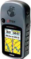 | Outdated Product Application area: handheld; Water protection; Number of routes: 50; Waypoints: 500; Navigation features: Bands number: 12; screen size ("): 2.1; resolution (px): 176x220; USB; memory card slot; Battery life (h): 32; Dimensions (mm): 107x56x30; Weight (g): 156; E-Catalog uses affiliate links compensated by our partners. |
We recommend products in stockSat Navs Garmin →
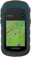
handheld, 2.2 ", water protection IPX7, non chargeable batteries, up to 25 hours of work, 142 g
handheld, 2.2 ", water protection IPX7, non chargeable batteries, up to 168 hours of work, 157 g
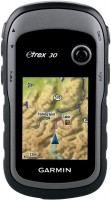
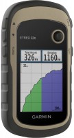
handheld, 2.6 ", water protection IPX7, non chargeable batteries, up to 18 hours of work, 203 g
handheld, 2.2 ", memory 8 GB, water protection IPX7, non chargeable batteries, up to 25 hours of work, 142 g
handheld, 2.2 ", memory 3.7 GB, water protection IPX7, non chargeable batteries, up to 25 hours of work, 142 g
handheld, 2.6 ", water protection IPX7, non chargeable batteries, up to 20 hours of work, 260 g
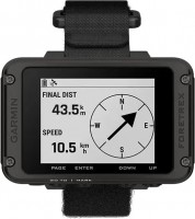
wrist-mounted, 2.2 ", ANT+, water protection IPX7, non chargeable batteries, up to 100 hours of work, 108 g
handheld, 2.2 ", memory 8 GB, ANT+, water protection IPX7, non chargeable batteries, up to 25 hours of work, 142 g
handheld, 3 ", memory 8 GB, water protection IPX7, non chargeable batteries, up to 19 hours of work, 282 g
handheld, 2.6 ", memory 16 GB, ANT+, water protection IPX7, non chargeable batteries, up to 16 hours of work, 217 g
handheld, 2.6 ", memory 8 GB, ANT+, non chargeable batteries, up to 16 hours of work, 230 g
handheld, 3 ", memory 16 GB, Wi-Fi, ANT+, water protection IPX7, up to 180 hours of work, 230 g
handheld, 2.6 ", memory 16 GB, ANT+, water protection IPX7, non chargeable batteries, up to 16 hours of work, 217 g
Garmin eTrex Legend Cx
Type:handheld
Screen size:2.1 "
Resolution:176x220 px
Power supply:non chargeable battery
Working hours:up to 32 h
Weight:156 g
All specifications
Specifications eTrex Legend Cx
|
| |||||||||||||||||||||||||||||||||||||||||||||||||||||||||||||
The information in the model description is for reference purposes.
Always clarify the specifications and configuration of the product with the online store manager before purchasing.
Catalog Garmin 2026 - new arrivals, bestsellers, and the most relevant models Garmin.
Always clarify the specifications and configuration of the product with the online store manager before purchasing.
Catalog Garmin 2026 - new arrivals, bestsellers, and the most relevant models Garmin.
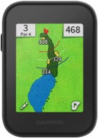
Series Garmin eTrex (handheld)Compare using chart →
handheld, 2.2 ", water protection IPX7, non chargeable batteries, up to 168 hours of work, 157 g
handheld, 2.2 ", memory 8 GB, ANT+, water protection IPX7, non chargeable batteries, up to 25 hours of work, 142 g
handheld, 2.2 ", memory 8 GB, water protection IPX7, non chargeable batteries, up to 25 hours of work, 142 g
handheld, 2.2 ", water protection IPX7, non chargeable batteries, up to 25 hours of work, 142 g
handheld, 2.2 ", memory 3.7 GB, water protection IPX7, non chargeable batteries, up to 25 hours of work, 142 g
Additional features sat nav Garmin eTrex Legend Cx:
WAAS technology
WAAS (Wide Area Augmentation System) is a system designed to increase the accuracy of satellite navigation instruments. The principle of operation of the system is based on the correction of satellite data using special corrections, which are calculated by base stations installed in the service area of the system.
- WAAS technology
- Self-installation of POI points
- Possibility to update the firmware
- Hunter/fisher calendar
- Sunrise/sunset and moon phase information
- Built-in GPS games
- Area calculation
- Strap
- Memory card 64 MB microSD
- Database: offshore objects
- MapSource Trip & Waypoint Manager Software
- USB cable
- Brief instruction
- User guide
WAAS technology
WAAS (Wide Area Augmentation System) is a system designed to increase the accuracy of satellite navigation instruments. The principle of operation of the system is based on the correction of satellite data using special corrections, which are calculated by base stations installed in the service area of the system.