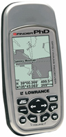
Lowrance iFinder PHD
 | Outdated Product $480.00 Portable universal GPS navigator. Small size and weight, as well as dust and moisture resistance, allow you to take it on any trip or trip where you might need it. If necessary, new maps of the area can be loaded into the device, for this it is convenient to use the SD/MMC memory card slot. The navigator has a barometric altimeter and an electronic compass. True, the use of the latter significantly discharges the batteries. |
Close
We recommend products in stockSat Navs Lowrance →

handheld, 3 ", memory 16 GB, Wi-Fi, ANT+, water protection IPX7, up to 180 hours of work, 230 g
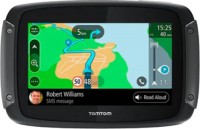
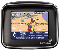
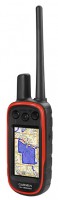
motorcycle, 3.4 ", memory 16 GB, Live Traffic, GPS informer, Wi-Fi, water protection IPX7, up to 6 hours of work, 280 g

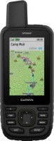
handheld, 3 ", memory 16 GB, Wi-Fi, ANT+, water protection IPX7, up to 180 hours of work, 230 g
handheld, 3 ", water protection IPX7, non chargeable batteries, up to 20 hours of work, 250 g
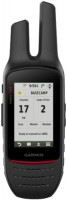
handheld, 3 ", memory 16 GB, Wi-Fi, ANT+, water protection IPX7, up to 35 hours of work, 230 g
handheld, 3 ", memory 8 GB, water protection IPX7, non chargeable batteries, up to 19 hours of work, 282 g
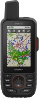
handheld, 3.5 ", memory 16 GB, Wi-Fi, ANT+, water protection IPX7, up to 55 hours of work, 280 g

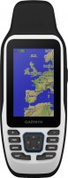
handheld, 3.5 ", memory 16 GB, Wi-Fi, ANT+, water protection IPX7, up to 55 hours of work, 280 g
Lowrance iFinder PHD
Type:handheld
Screen size:3 "
Resolution:180х240 px
Power supply:non chargeable battery
Working hours:up to 12 h
Weight:247 g
Portable universal GPS navigator. Small size and weight, as well as dust and moisture resistance, allow you to take it on any trip or trip where you might need it. If necessary, new maps of the area can be loaded into the device, for this it is convenient to use the SD/MMC memory card slot. The navigator has a barometric altimeter and an electronic compass. True, the use of the latter significantly discharges the batteries.
All specifications
Specifications iFinder PHD
|
| |||||||||||||||||||||||||||||||||||||||||||||||||||||||||||
The information in the model description is for reference purposes.
Always clarify the specifications and configuration of the product with the online store manager before purchasing.
Catalog Lowrance 2025 - new arrivals, bestsellers, and the most relevant models Lowrance.
Always clarify the specifications and configuration of the product with the online store manager before purchasing.
Catalog Lowrance 2025 - new arrivals, bestsellers, and the most relevant models Lowrance.
Good to know:
WAAS technology
WAAS (Wide Area Augmentation System) is a system designed to increase the accuracy of satellite navigation instruments. The principle of operation of the system is based on the correction of satellite data using special corrections, which are calculated by base stations installed in the service area of the system.