Globalsat BT-335
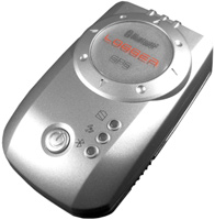 | Outdated Product Universal external GPS module with WAAS technology support. Receiving correction signals from base stations can significantly increase the accuracy of determining your coordinates. The device can exchange data via a wireless Bluetooth channel, the maximum communication distance is 10 m. The module can work as a source of location information with any external device that supports the NMEA 0183 protocol. There is a built-in battery. E-Catalog uses affiliate links compensated by our partners. |
We recommend products in stockSat Navs Globalsat →
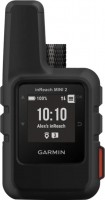
handheld, 1 ", ANT+, water protection IPX7, battery 1250 mAh, up to 96 hours of work, 100 g
Globalsat BT-335
Type:handheld
Interfaces:Bluetooth
Working hours:up to 25 h
Weight:75 g
Universal external GPS module with WAAS technology support. Receiving correction signals from base stations can significantly increase the accuracy of determining your coordinates. The device can exchange data via a wireless Bluetooth channel, the maximum communication distance is 10 m. The module can work as a source of location information with any external device that supports the NMEA 0183 protocol. There is a built-in battery.
All specifications
Specifications BT-335
|
| |||||||||||||||||||||||||||||||||||||||
The information in the model description is for reference purposes.
Always clarify the specifications and configuration of the product with the online store manager before purchasing.
Catalog Globalsat 2026 - new arrivals, bestsellers, and the most relevant models Globalsat.
Always clarify the specifications and configuration of the product with the online store manager before purchasing.
Catalog Globalsat 2026 - new arrivals, bestsellers, and the most relevant models Globalsat.
Additional features sat nav Globalsat BT-335:
WAAS technology
WAAS (Wide Area Augmentation System) is a system designed to increase the accuracy of satellite navigation instruments. The principle of operation of the system is based on the correction of satellite data with the help of special corrections, which are calculated by base stations installed in the service area of the system.
- NMEA 0183 protocol operation
- Support for WAAS technology
WAAS technology
WAAS (Wide Area Augmentation System) is a system designed to increase the accuracy of satellite navigation instruments. The principle of operation of the system is based on the correction of satellite data with the help of special corrections, which are calculated by base stations installed in the service area of the system.